
Rotorua - Day 3 (1/2)
September 16, 2023 • 8 minutes • 1638 words • Other languages: Deutsch
Table of Contents
Today we woke up to bright sunshine, which is why we directly put out the solar panel during breakfast to charge our external battery. 🌞 Afterwards we had to go a few meters further to buy a permit at the Kawerau i-SITE Visitor Information Centre, since our first destination for today was on private land. The nice lady at the counter additionally equipped us with a map on which she had marked the way to the correct entrance into the forest.
For safety’s sake we had opened the route additionally on Maps, in order to be able to at least see over GPS, where we were, since we would certainly have no reception again. We set off and shortly after passing a sign indicating private land, we were stopped and asked for our permit.
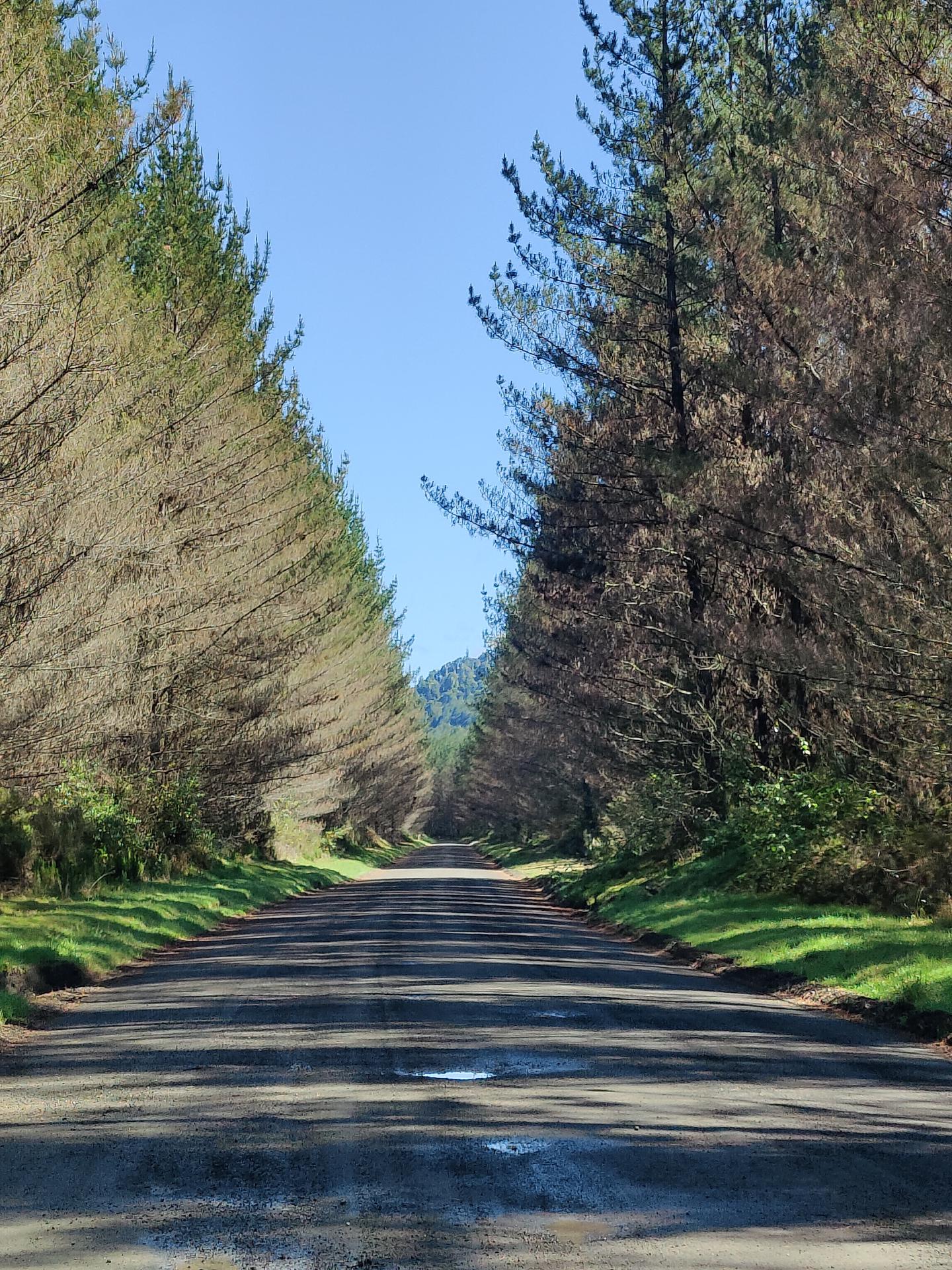
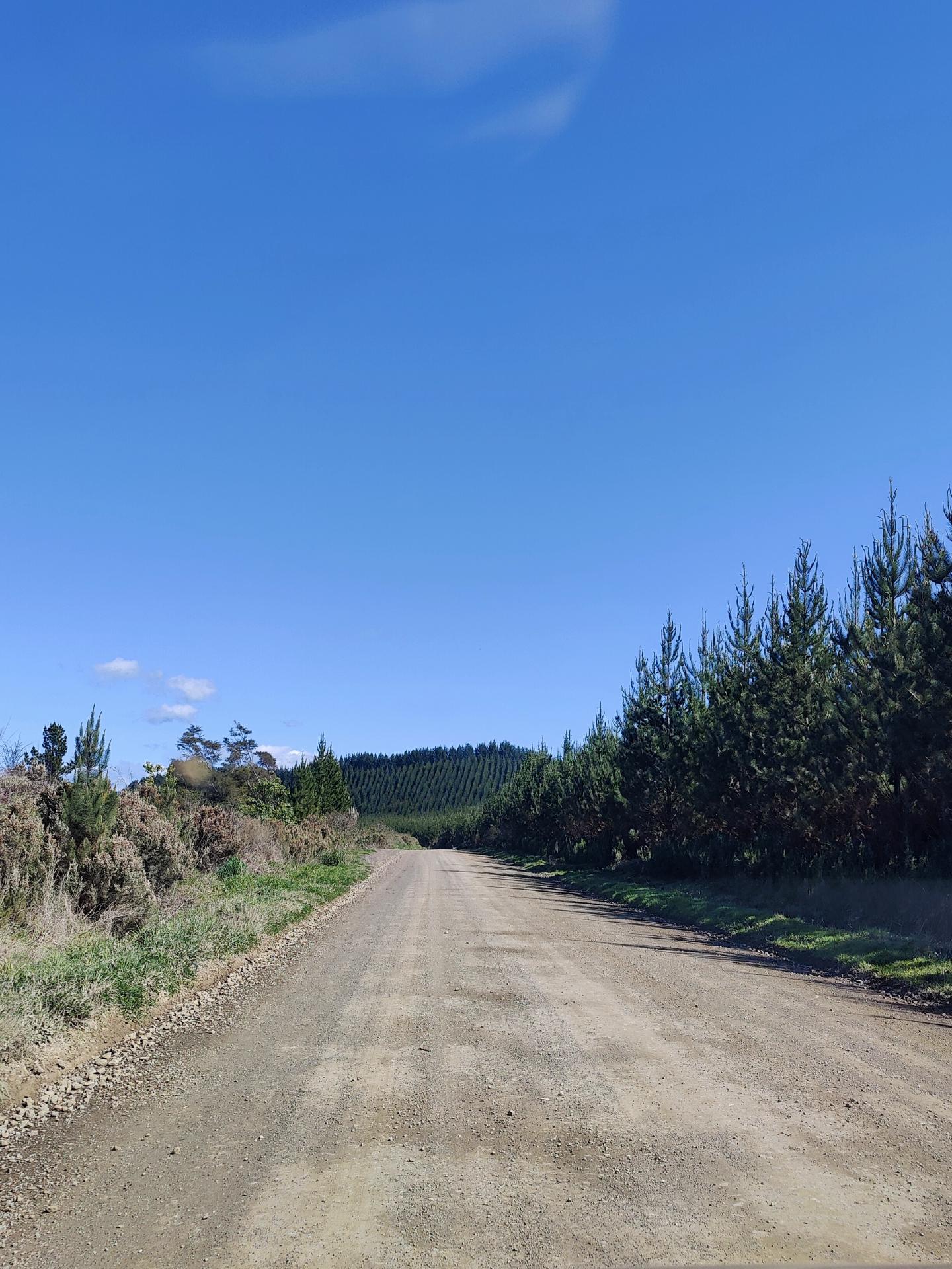
A short conversation later we continued: 20 km on a gravel road through the Tarawera Forest. 🌲
Tarawera Forest
However, the gravel road was much wider and - at least at the beginning - less rough than we would have expected. In addition, the changing landscape was surprisingly beautiful to look at. The first part was straight through the forest, while the trees were even smaller most of the way, so it was easy to see over them.
As the name suggests, from the Tarawera Forest you can also see Mount Tarawera, which we had already seen from Rotorua the previous days.
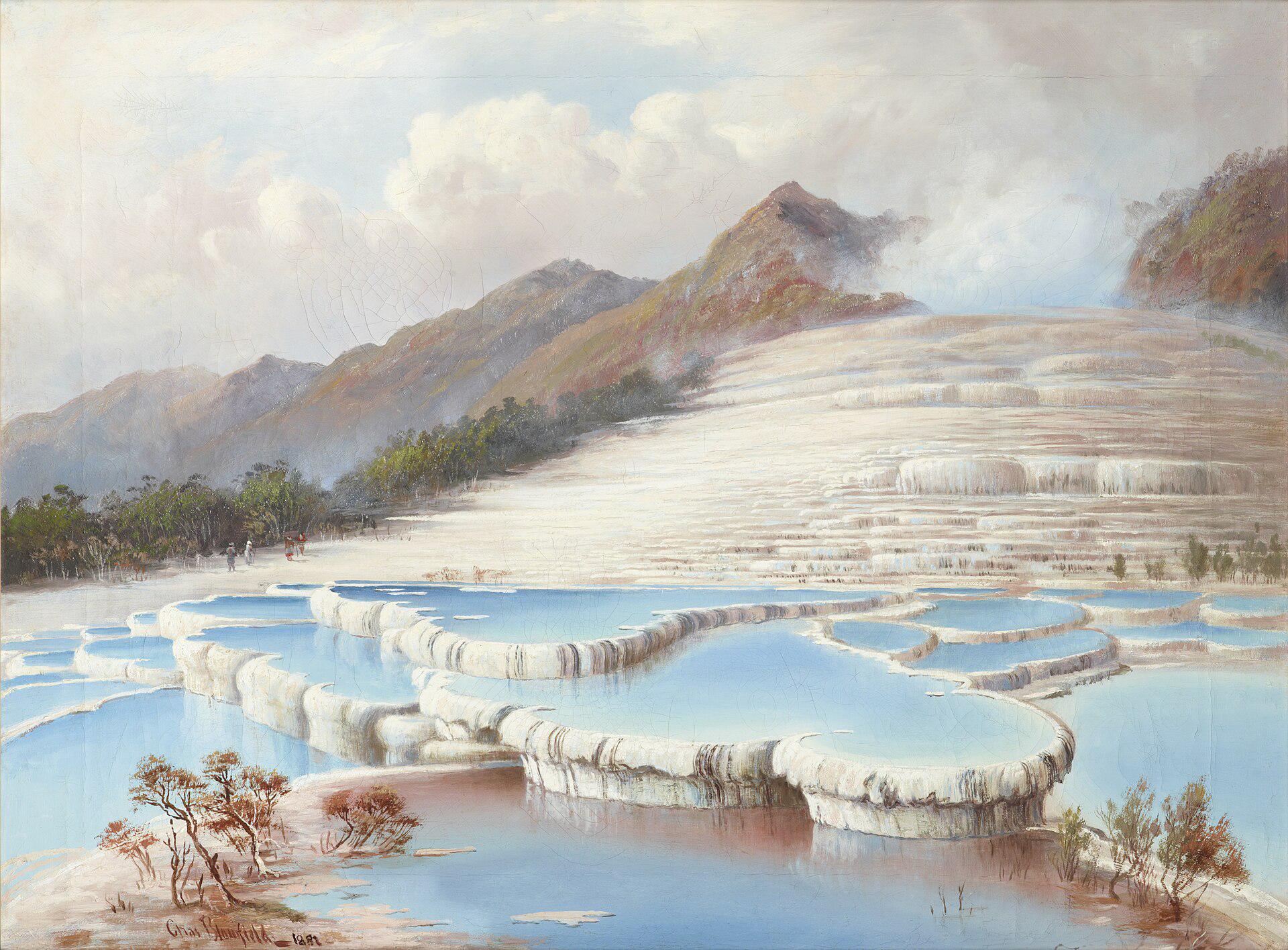
Towering high above Rotorua, Mount Tarawera is revered by the native Māori. The mountain became famous after the fateful events of 1886, when Mount Tarawera erupted and killed about 120 people. The surrounding area was also devastated, including what was once known as “the eighth wonder of the world” - the Pink and White Terraces.
Today, the mountain and Lake Tarawera, which lies at the base of Mount Tarawera, offer visitors hiking trails through native bush, as well as views of the Tarawera Falls - our destination for today.
About half an hour later we arrived at the parking lot and starting point of our little hike today.
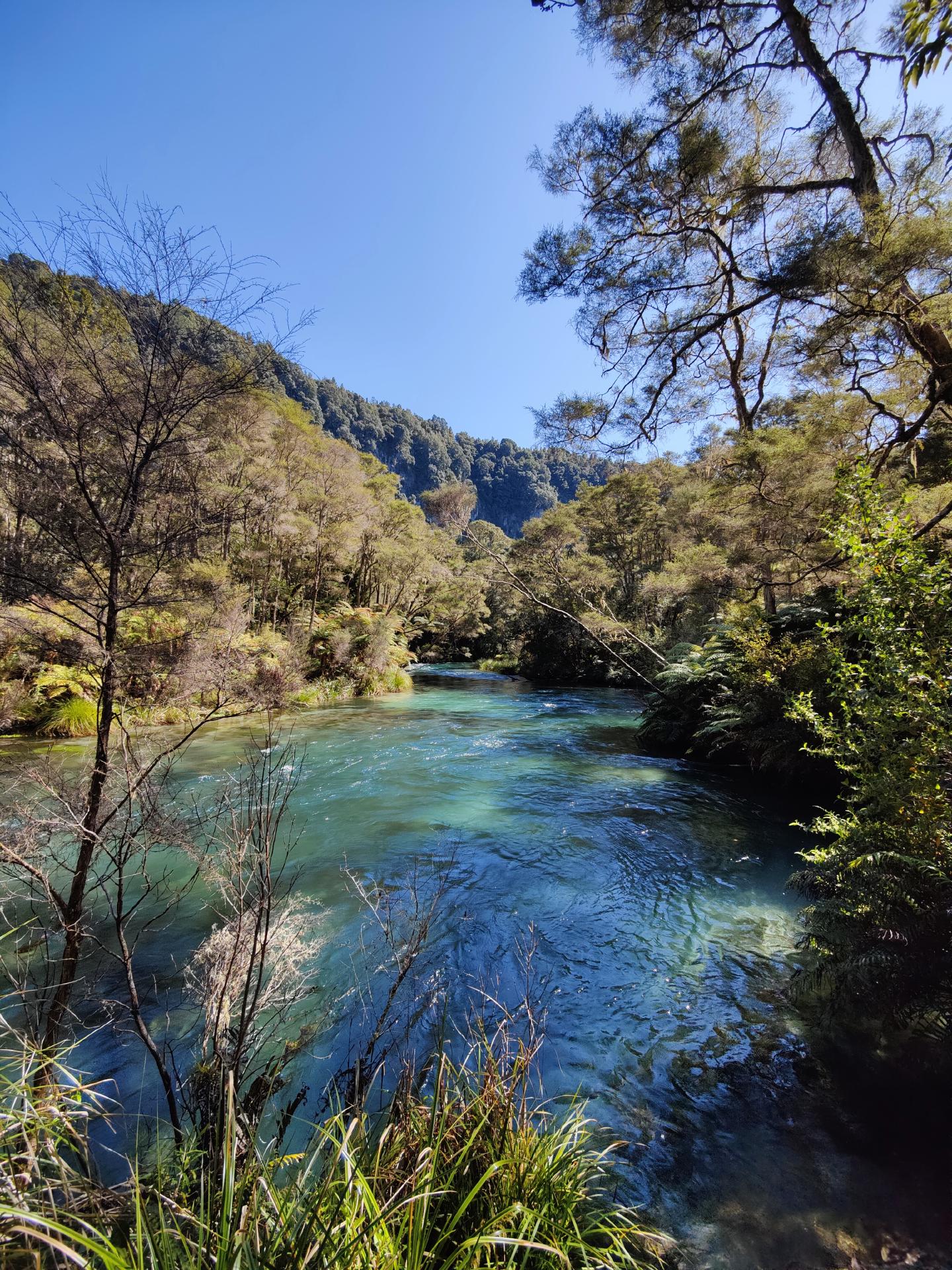
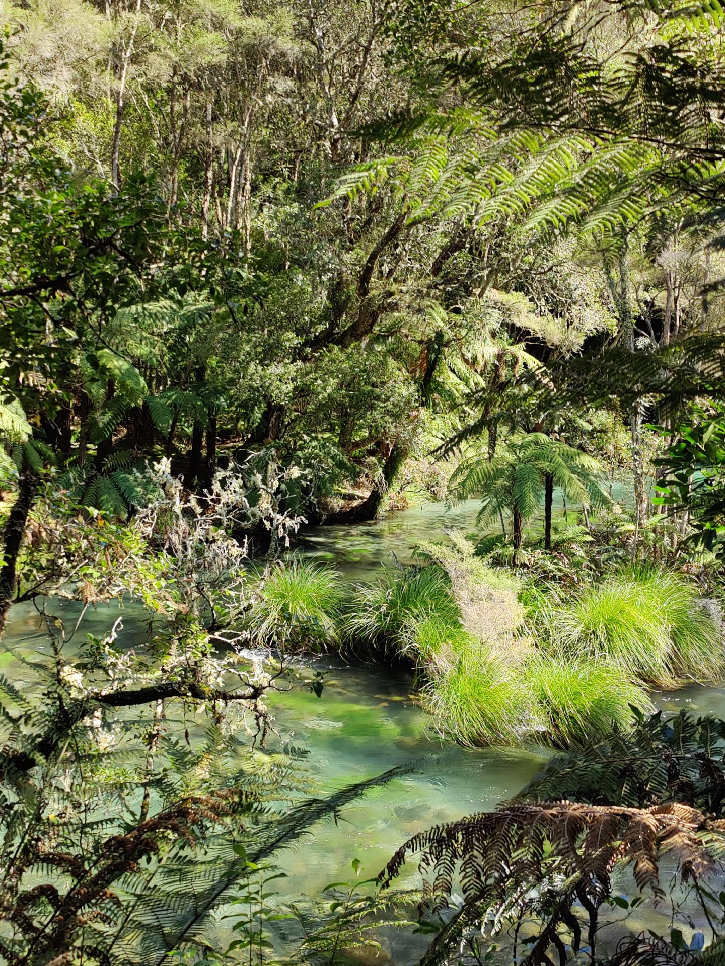
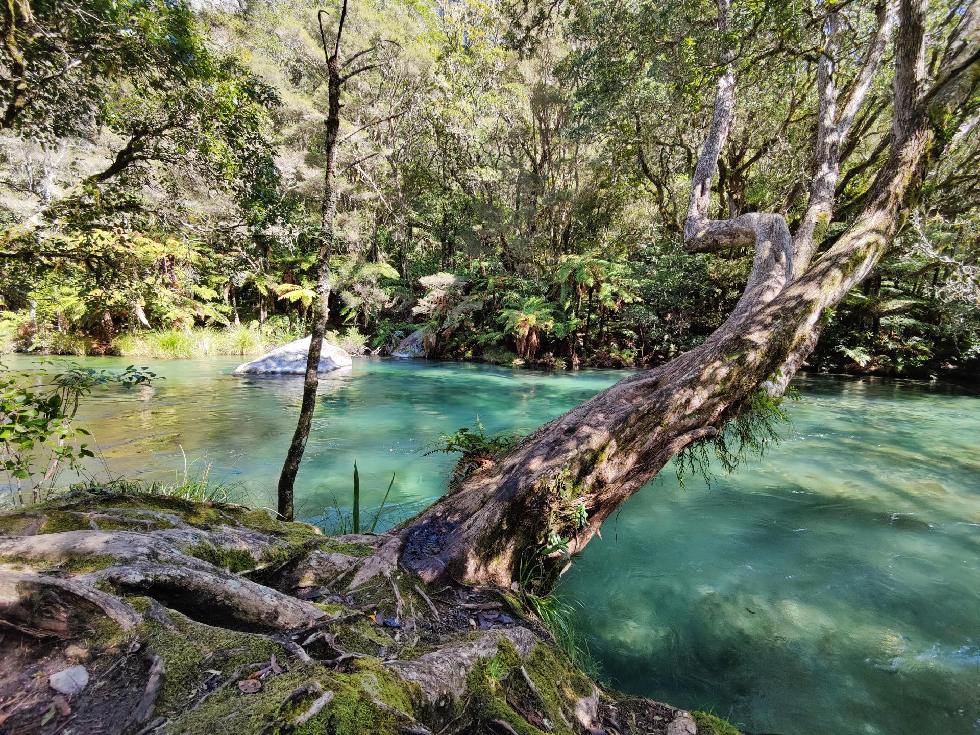
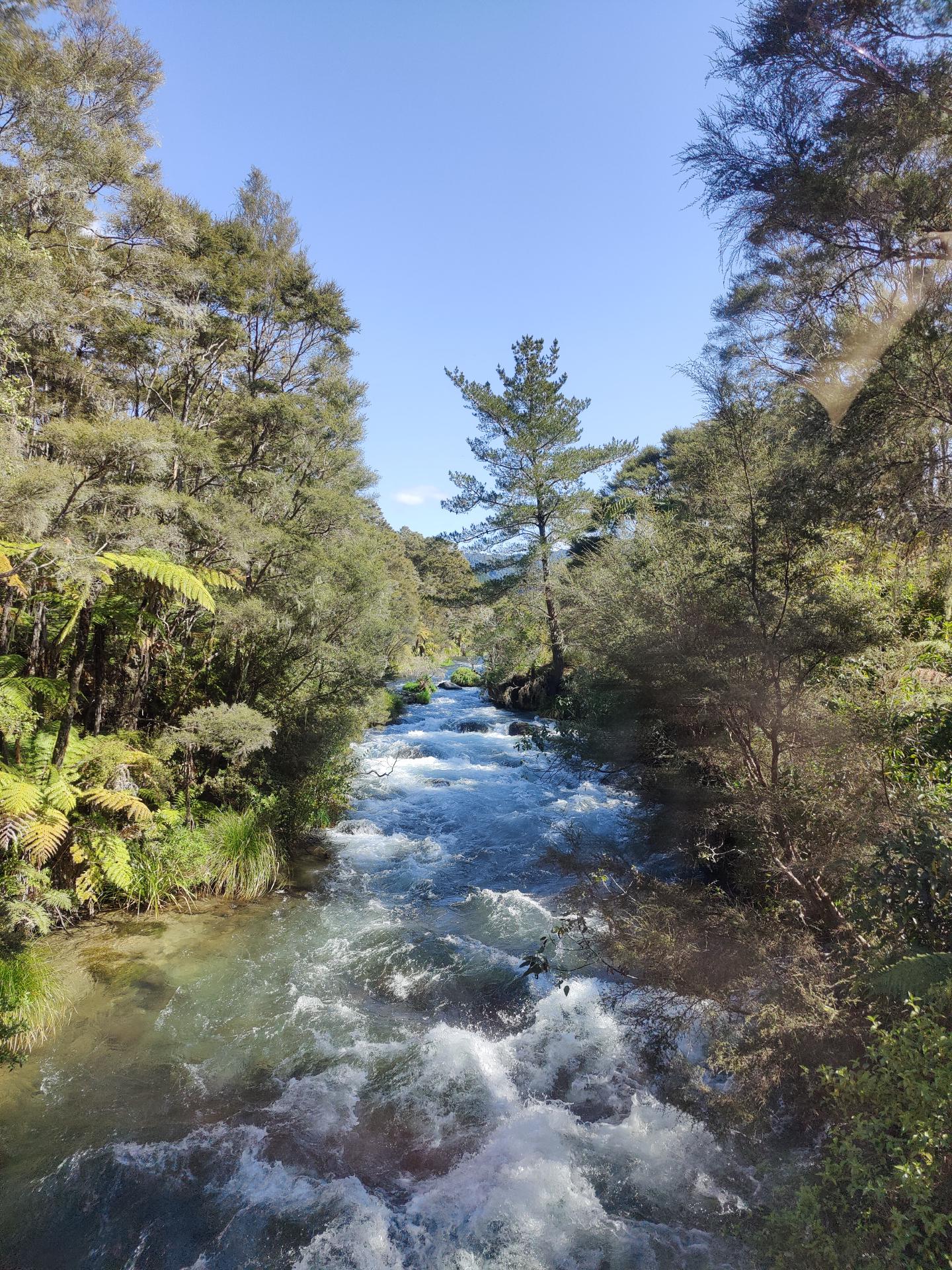
The hiking trail already followed the crystal clear Tarawera River at the beginning.
Shortly before our destination we had to cross the river …
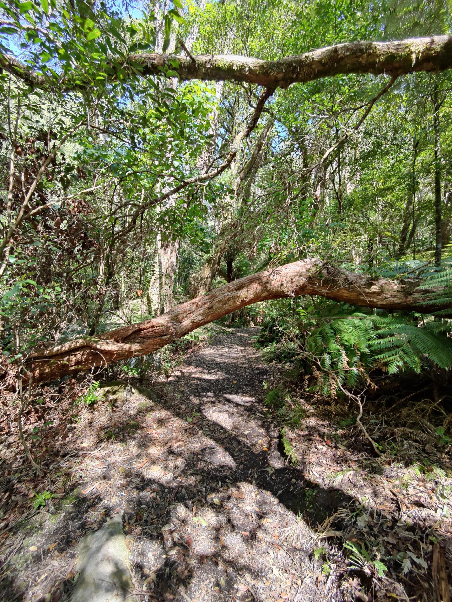
… and pass under a fallen tree …
… before we arrived at the waterfall. One could already hear the roaring water masses from a distance, which poured down here.
Tarawera Falls
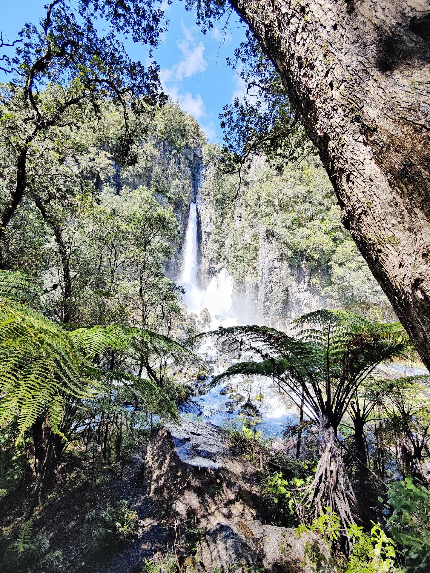
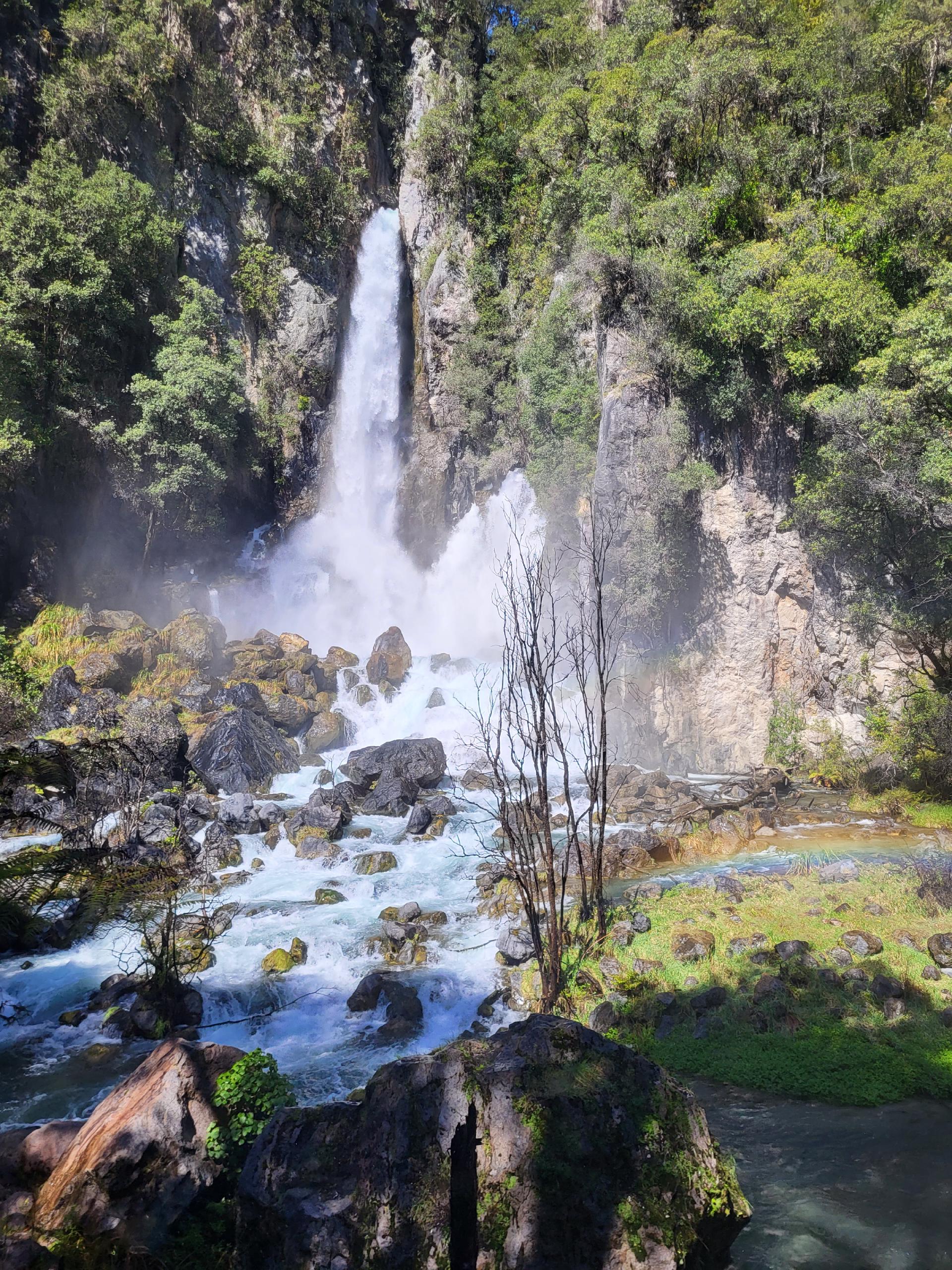
The Tarawera Falls are actually two waterfalls in one. A typical waterfall flowing over a cliff - with a drop of an impressive 65 m - and a second waterfall, only 35 m high but still quite spectacular, shooting out from between the rocks.
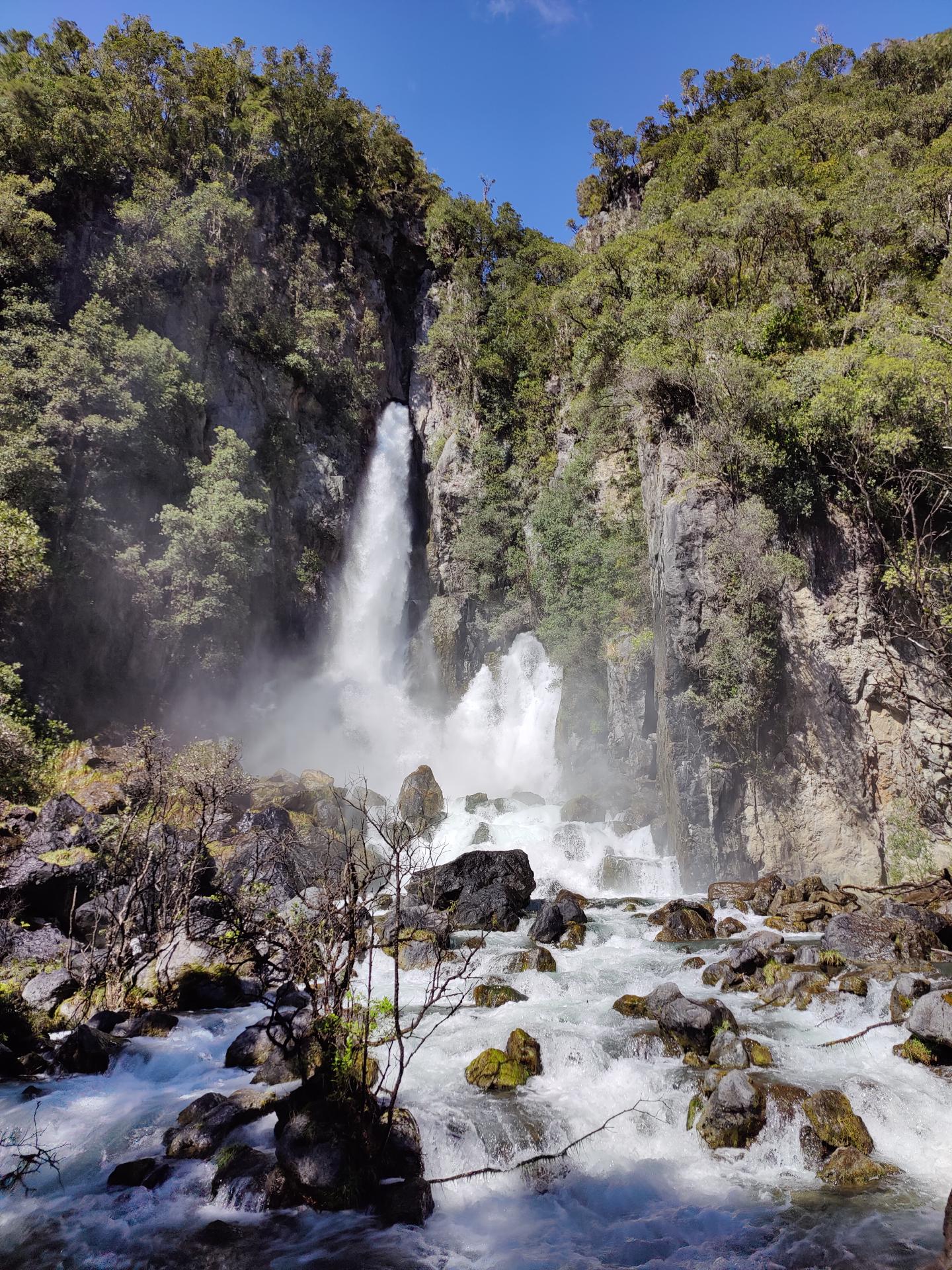
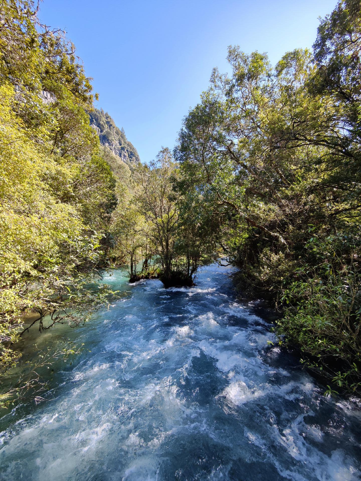
The latter is fed by the so-called Disappearing River. The river above the falls is very interesting: it splits, and while part of it continues to flow downstream, as a normal river should, most of it simply disappears into the ground.
In the course of the Tarawera River, there are some pools, but swimming in them is forbidden. In fact, at the bottom of the pools, there are entrances to the underground river.
The most spectacular thing, however, is the resurfacing of the underground river, which bursts out of the rock wall as if from a dam that is about to break. Because of the shortness of time, we did not walk the rest of the way to Lake Tarawera.
When the sun was just right, beautiful rainbows formed around the waterfall.
The rocks around the waterfall were very wet and slippery, so we did not go closer than up to the river. Even here, though, you got really wet from the water drops.
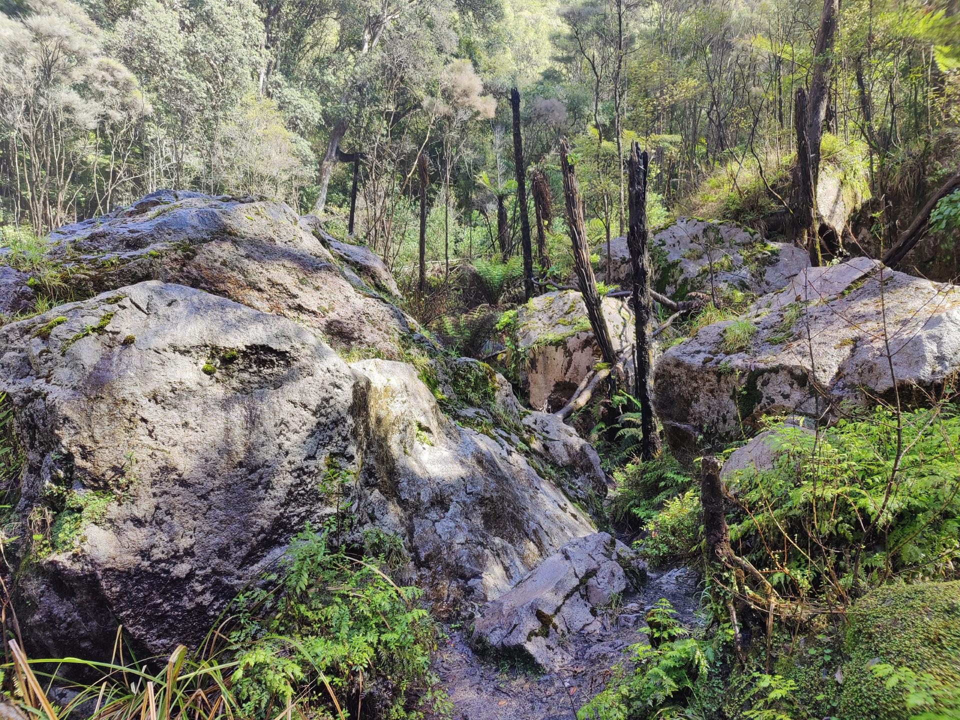
Afterwards we followed the path a bit further, hoping that there might be a viewpoint at the top, but we got disappointed. After that we headed back to the car to try to find our way out of the forest again without a map.
There were a few more streams to cross and some forks off the trail, but we made it back out without any detours.
Pink and White Terraces
Right next to Lake Tarawera is Lake Rotomahana. The Pink and White Terraces were reportedly the largest silica sinter deposits in the world. They once dominated the shoreline of Lake Rotomahana.
The Pink and White Terraces were formed over hundreds of years. Rich geothermal water from boiling geysers flowed downhill to Lake Rotomahana. As the water cooled, the silica crystallized and formed terraces. This creates steps in layers, and when the geothermal water drips over the steps, pools form. The pink color of the Pink Terrace is due to sulphides in the water.
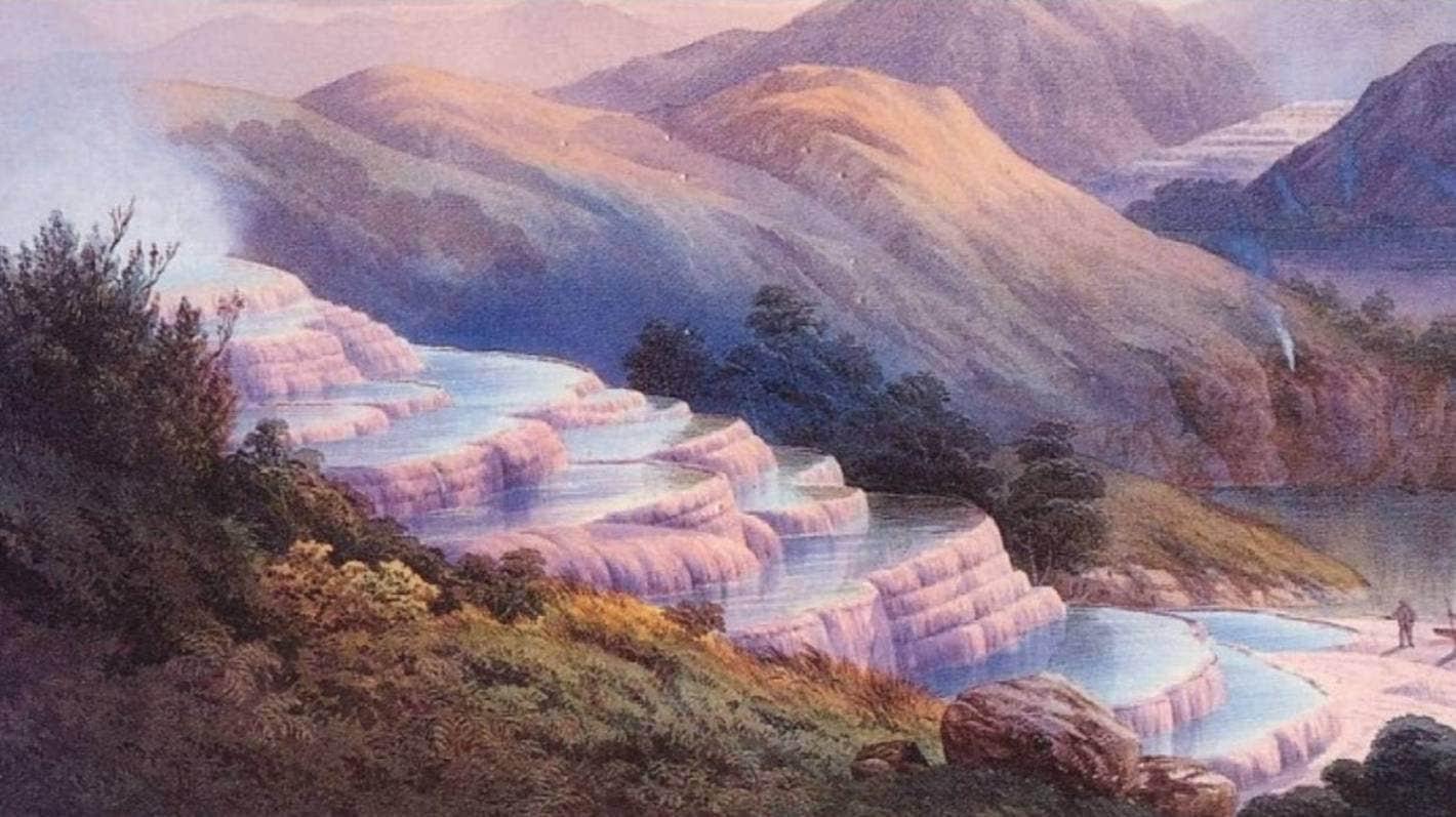
The Pink and White Terraces were New Zealand’s first tourist attraction and were considered the Eighth Wonder of the World. People came from far and wide to see the terraces and bathe in the pools they created.
When Mount Tarawera erupted in 1886, destroying the Waimangu Valley and blasting Lake Rotomahana to twenty times its original size, the Pink and White Terraces were destroyed or buried under the lake floor. All vegetation in the Waimangu Volcanic Valley was obliterated, and the village of Te Wairoa, located there, was buried by the rocks, ash, and mud thrown out by the eruption. The terraces were considered lost forever.
Back in Kawerau we found a park bench with a table next to our last sleeping place, where we had lunch right away and fed some birds before we drove back to Rotorua.
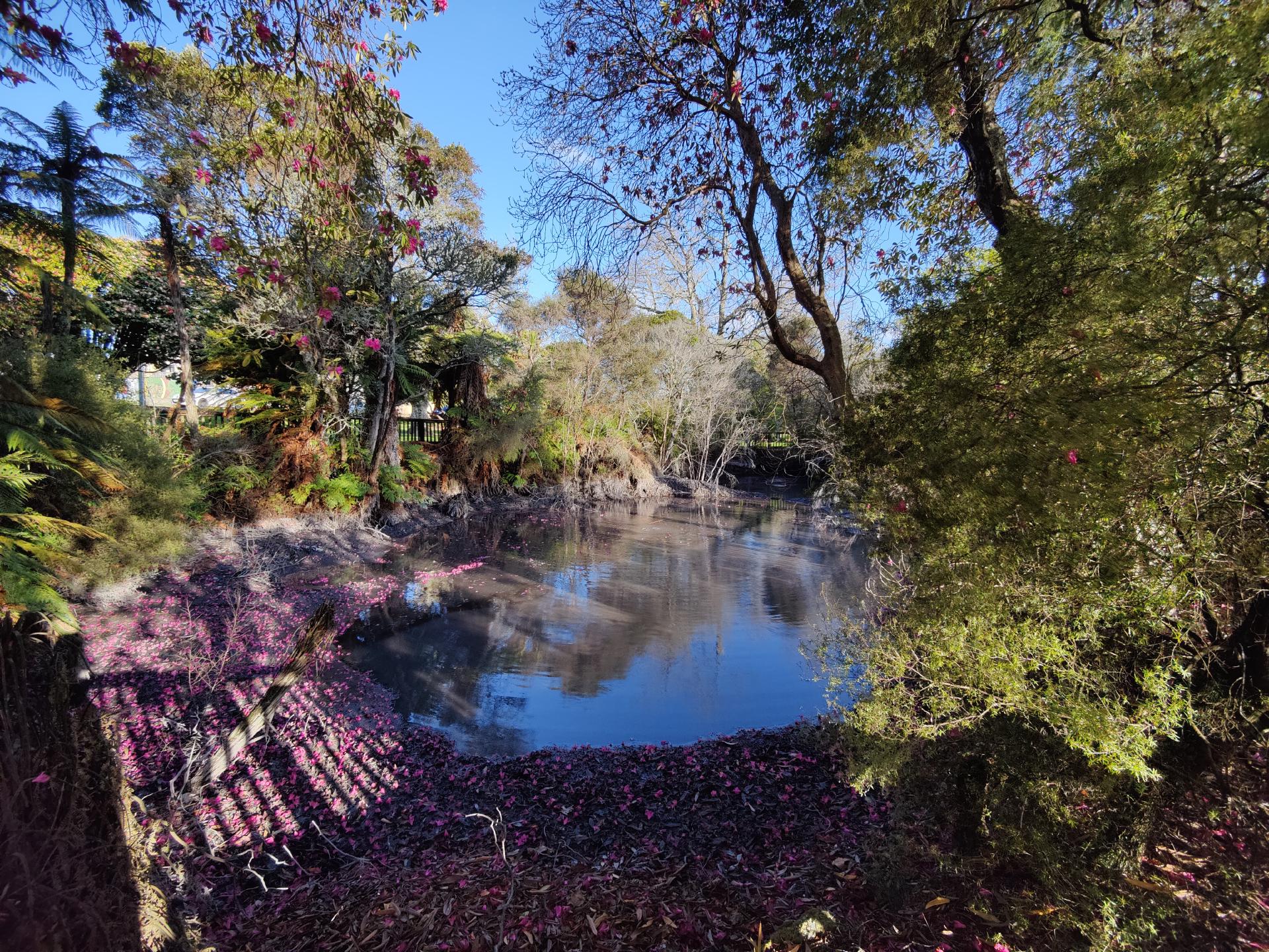
We spent the time until the next evening event we had booked at Kuirau Park - the only free public geothermal park in New Zealand, located in the middle of Rotorua.
Kuirau Park
Several hiking trails lead through the park to visit the crater lake, mud pools, hot springs, and a free thermal foot bath. So the park hosts virtually every type of geothermal activity except a geyser. As long as you stay on the cool side of the safety fences, you should normally be relatively safe.
Mud pools are a major feature of the North Island landscape. They form under rainwater ponds from which steam and gas rise to the surface. Under the pressure of the rising acidic gases, the rocks at the surface produce clay, which then mixes with rainwater to form a muddy, bubbling goo or mud pool.
Because Rotorua is a rainy place, the mud pools are often quite diluted and look more like dark, muddy, boiling ponds. But the smaller mud puddles can be quite thick and look almost otherworldly.
New eruptions occur from time to time, so one should still be careful. In 2001, mud and rocks the size of footballs were suddenly hurled 10 meters into the air as a new steam vent spontaneously announced its arrival. Two years later, similar eruptions provided an unexpected surprise.
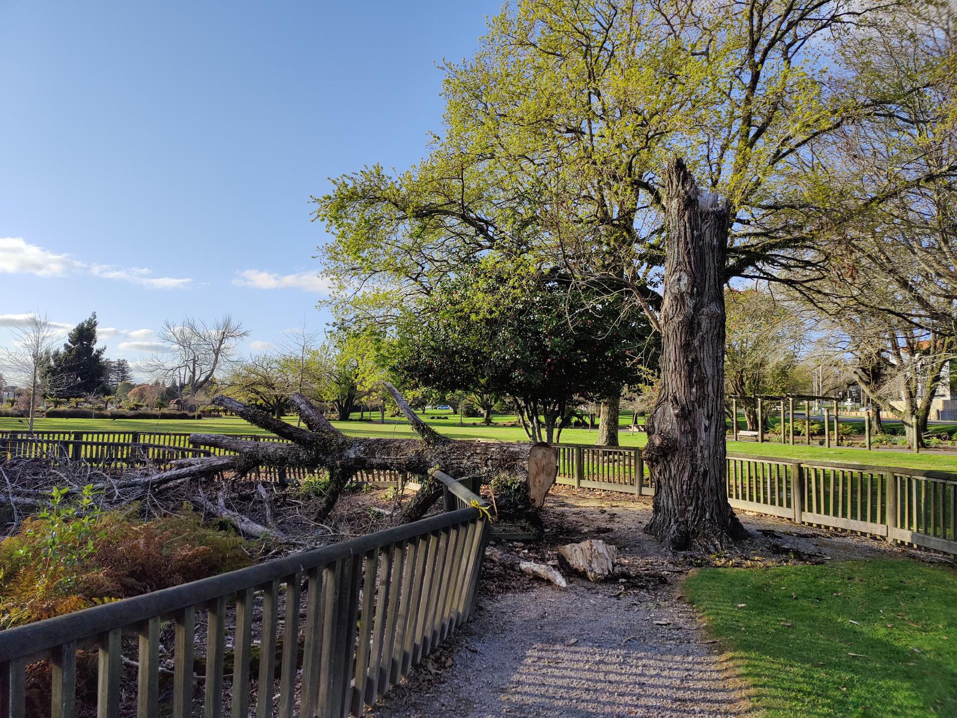
Part of the circular route was also closed due to a fallen tree (already the second one today 🧐).
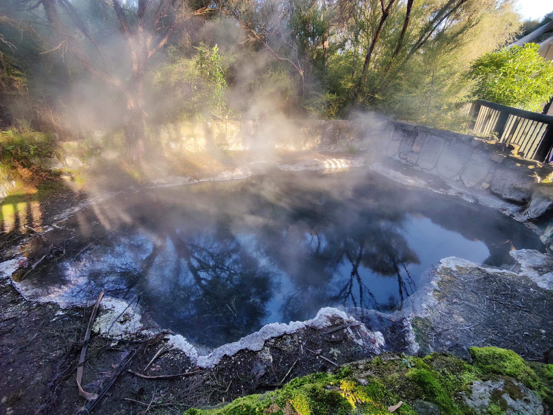
Generally, geothermal pools are classified as either alkaline chloride features or acid sulphate features, and the two differ significantly in appearance. And unlike Lake Rotorua, where most hot springs are acidic, the pools in Kuirau Park are predominantly alkaline.
Alkaline chloride pools are usually clear water springs that rise rapidly to the surface due to geothermal pressure. Very clear, often colorful, boiling springs are therefore water from the depths of the earth’s interior that has recently risen to the surface after traveling through heated rock layers.
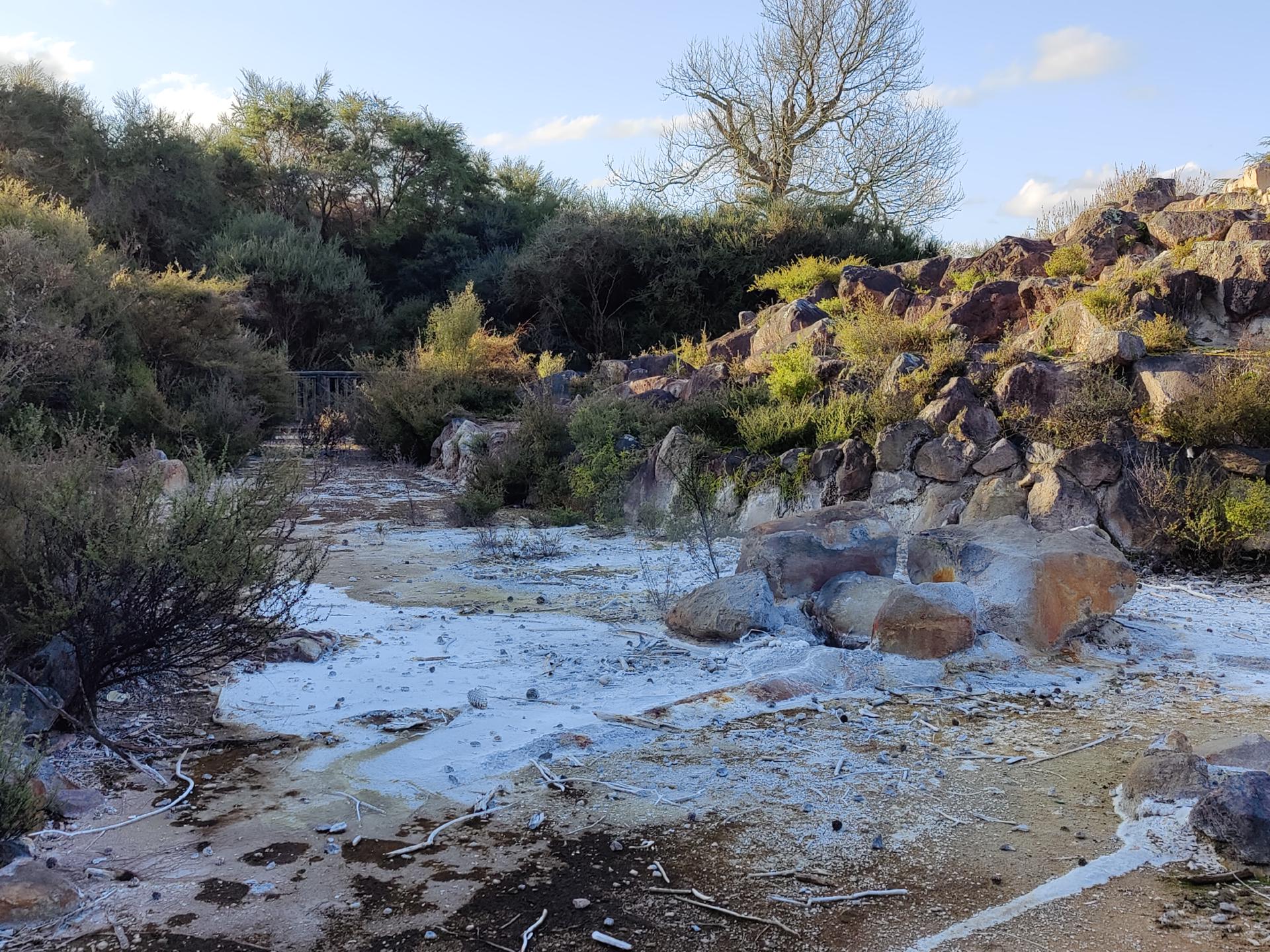
Unlike crystal clear alkaline pools, acid sulphate pools usually have a milky appearance. When water from the depths of the earth cannot reach the surface quickly enough, it begins to boil underground, and a mixture of steam and volcanic gases rises to the surface, forming an acidic sulphate layer. In the hot soup of water and gas, the hydrogen sulphide turns into sulphuric acid.
When hot geothermal water reaches the surface, it cools rapidly and deposits dissolved silica as sinter. This fine-grained, white silica covers every surface and grows over vegetation.
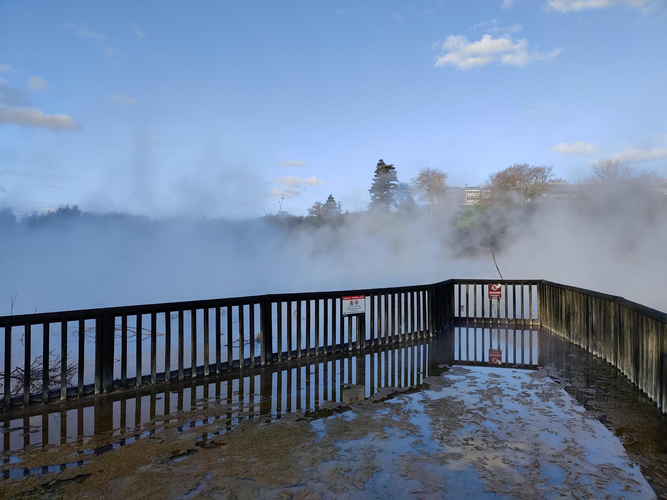
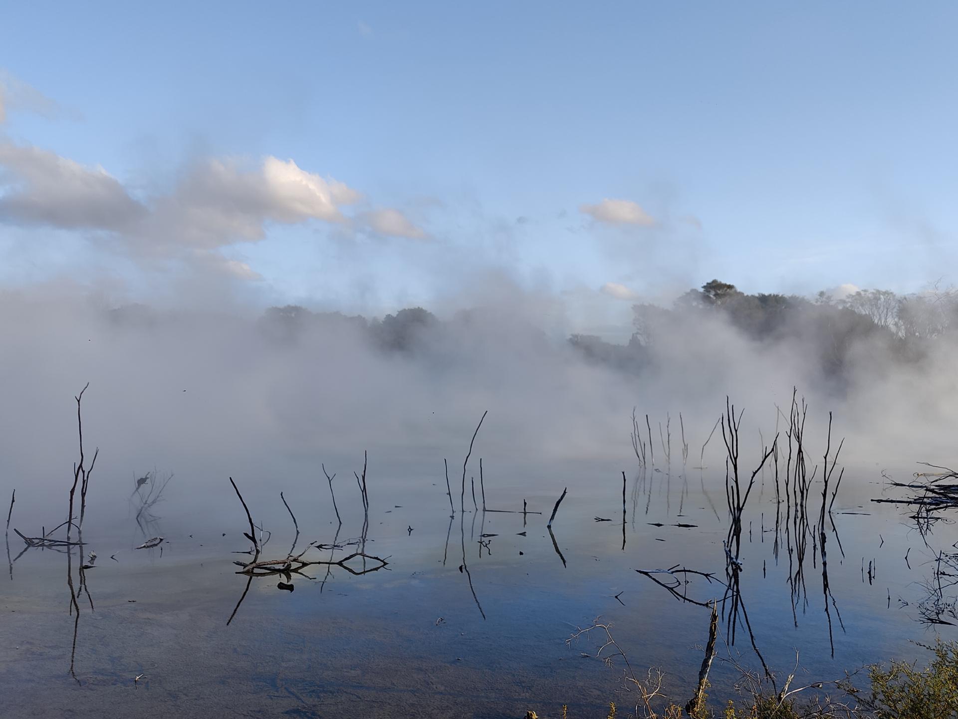
At the northernmost end of the park, there was the origin of the steam, which we had passed several times before. Even from a distance, it felt like we were walking towards a white wall of fog behind the trees, which cleared only slightly when we entered the small viewing platform.
Around the crater lake was a circular path, but after a few meters it was interrupted by the lake overflowing its banks.
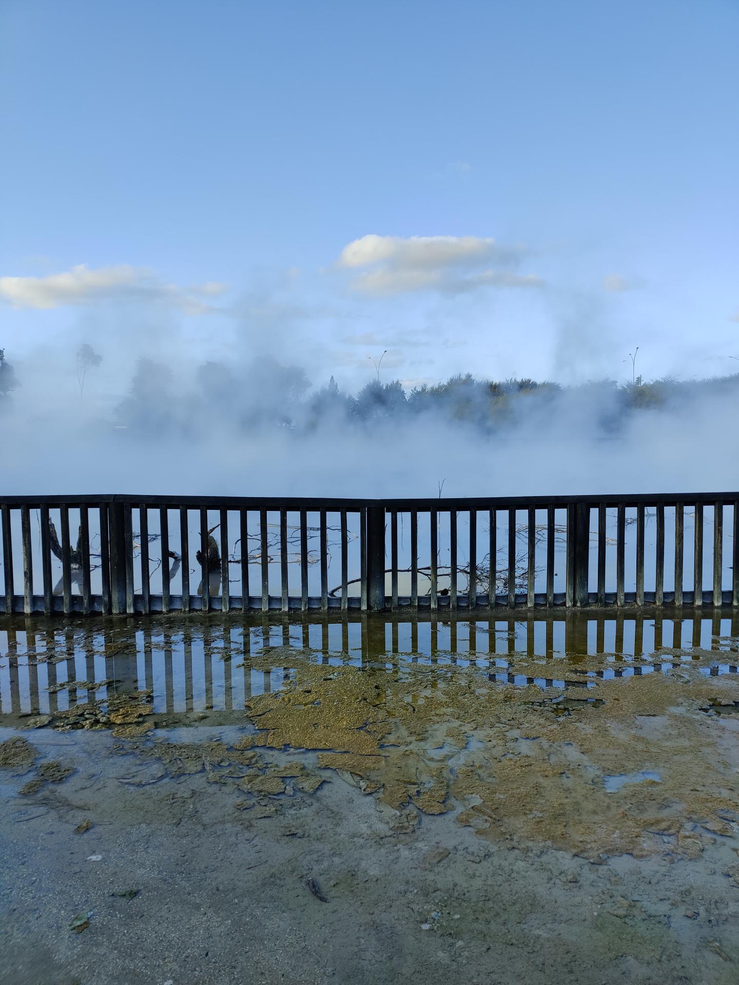
A few visitors in front of us tried to get over the flooded place, but this ended with a landing in the water. So we preferred to go around to get to the other side. A bridge, which normally leads across the lake, was unfortunately also closed. Probably because of the high water level, or the enormous steam formation, which completely blocked the view if you stood too close to the lake.
The experience was somehow very interesting, but also a bit scary at the same time, because on one side so much steam rose that you saw absolutely nothing - but as soon as you turned around, the sun shone through the bright blue sky.
… In early Māori times, the small lake in the park was much cooler and was known as Tawakahu. According to legend, a beautiful young woman named Kuiarau was bathing in the water when a Taniwha (mythical creature) dragged her into its cave below the lake. The gods were so enraged that they made the lake boil to get rid of the creature. Since that time, the bubbling lake and the steaming land around it have been known by the name of the lost woman, although the spelling has changed a bit …
Since it was getting quite late, we had to hurry back to the car to make it in time for tonight’s activity.