Northland - Day 6
December 10, 2023 • 5 minutes • 970 words • Other languages: Deutsch
Table of Contents
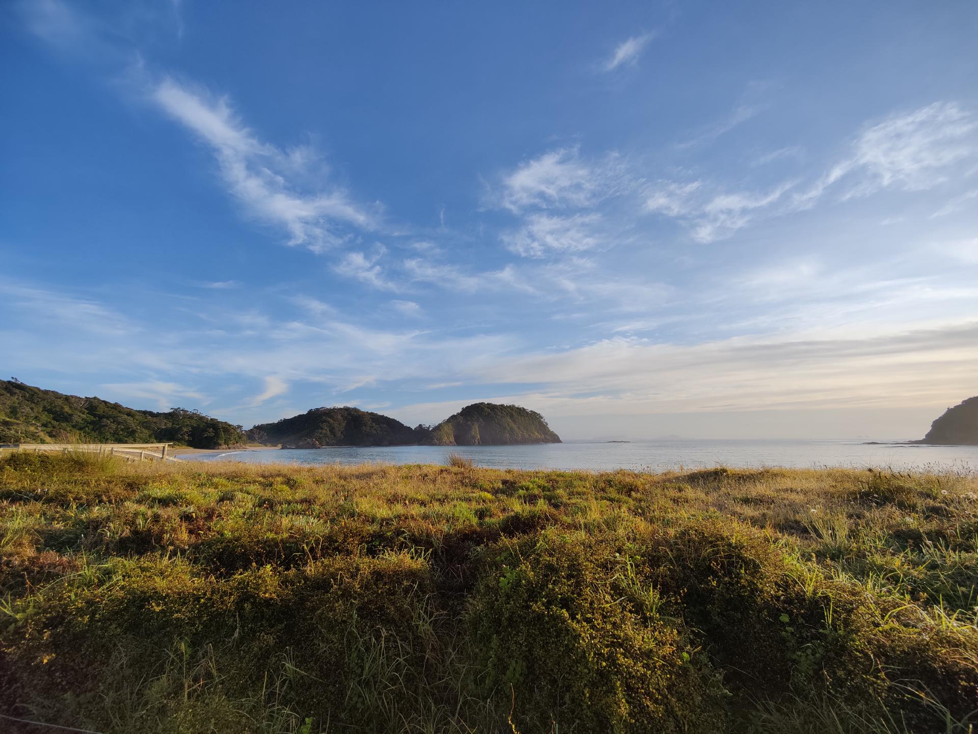
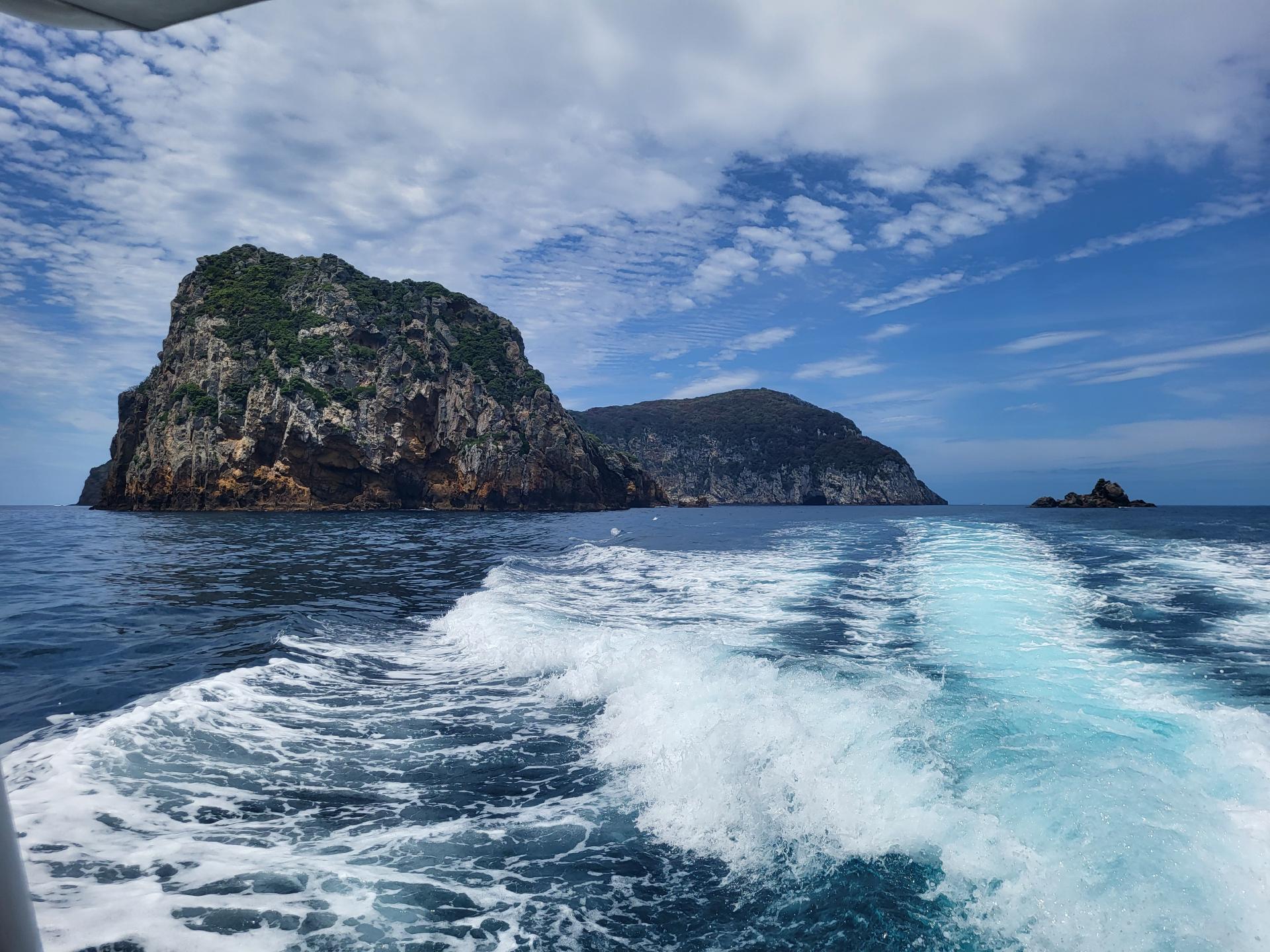
In the early morning we could already see the Poor Knights on the horizon, which we would visit for the second and last time today.
Ten million years ago, a large volcano erupted on the east coast of Northland - once possibly 1000 m high and with a diameter of 15-25 km. This volcano in the Pacific “ring of fire” fell silent and was eroded down to a hard core by weather, wind and waves over the course of many centuries.
What remains is a group of islands - Tawhiti Rahi, Aorangi, Sugarloaf, the Pinnacles and a number of small islands separated from the mainland by 24 km of sea.
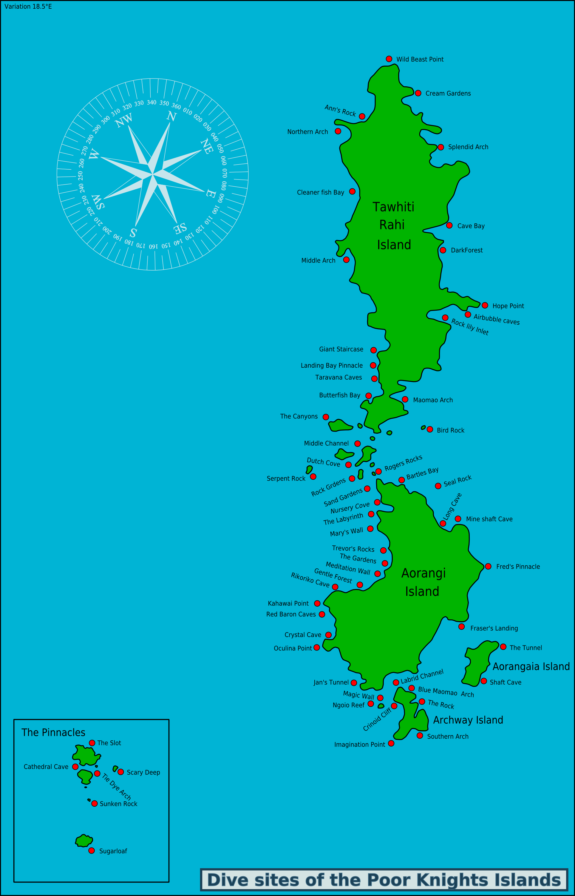
We did the first two dives yesterday at Aorangi Island at The Gardens, while today we were going to dive at Trevor’s Rock and Middle Arch on Tawhiti Rahi Island.
On the outward journey today, we saw lots of seabirds, some accompanying the boat and others drifting on the water. Between October and May, millions of seabirds from the Arctic Circle are said to flock to the islands to breed. The most common species is the Buller’s shearwater. They dig burrows in the volcanic soil and return to the same nest year after year. They share this burrow with the nocturnal Tuatara. At night, the tuatara leaves the burrow to feed and guards the eggs during the day, while the shearwater stays at sea to feed and rest on the surface. The Tuatara does not eat its host’s egg, and the bird does not attack its guest. This symbiotic relationship only exists on a few other offshore islands in New Zealand.
Trevor’s Rock
The first dive flew by again and we were able to complete the last exercises we had to do for our diving certificate. This meant that we were finally able to explore the underwater world on our last dive. First, however, our skipper drove us around the islands and showed us a few of the highlights.
The underwater topography east of the Northland coast is mostly flat, apart from the rocky cliffs of the Poor Knights Islands and the occasional underwater reef. The seabed drops off sharply behind the Poor Knights.
Both above and below the water, the islands are a unique collection of archways, tunnels and caves. In some places the cliffs are up to 240 m high and plunge another 90 m into the ocean.

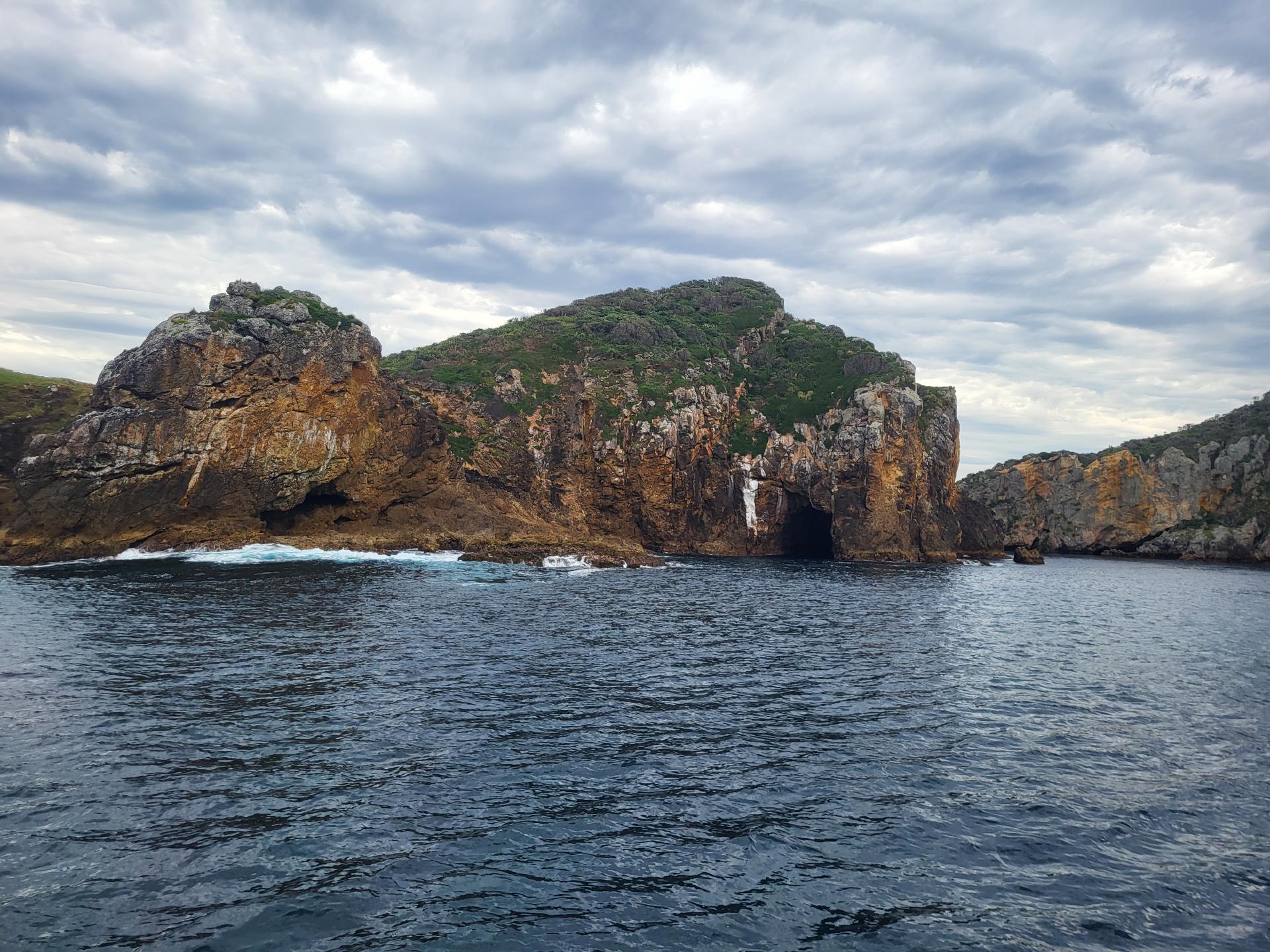
Rikoriko Cave
The most spectacular place was probably the Rikoriko Cave: the largest sea cave in the world in terms of volume. The rock walls and ceilings were all different colors, such as the green moss on the ceiling where the fresh water seeps through the rock.
Above our heads were about 200 m of rocks, while the water below us was about 15-30 m deep. In one corner of the cave, a large whale jaw bone lies in the sand at a depth of about 12 m. About 15 years ago, a sperm whale died at sea and accidentally found its way there. The DOC (Department of Conservation) towed it away, but it disintegrated, leaving only the jawbone.
On the edge of the cave wall, you could see how the light reflected by the water seemed to dance. In winter, the low sun supposedly comes directly into the entrance and illuminates the entire cave.
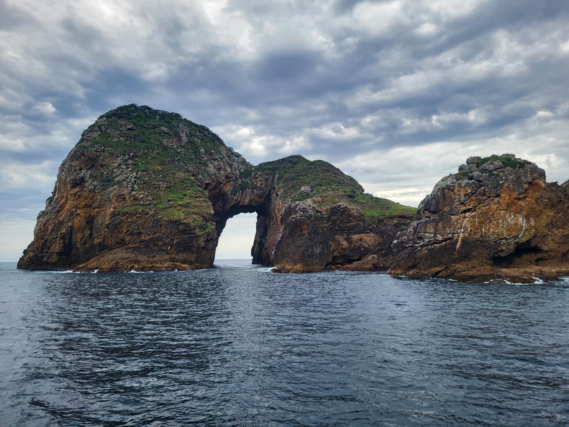
Middle Arch
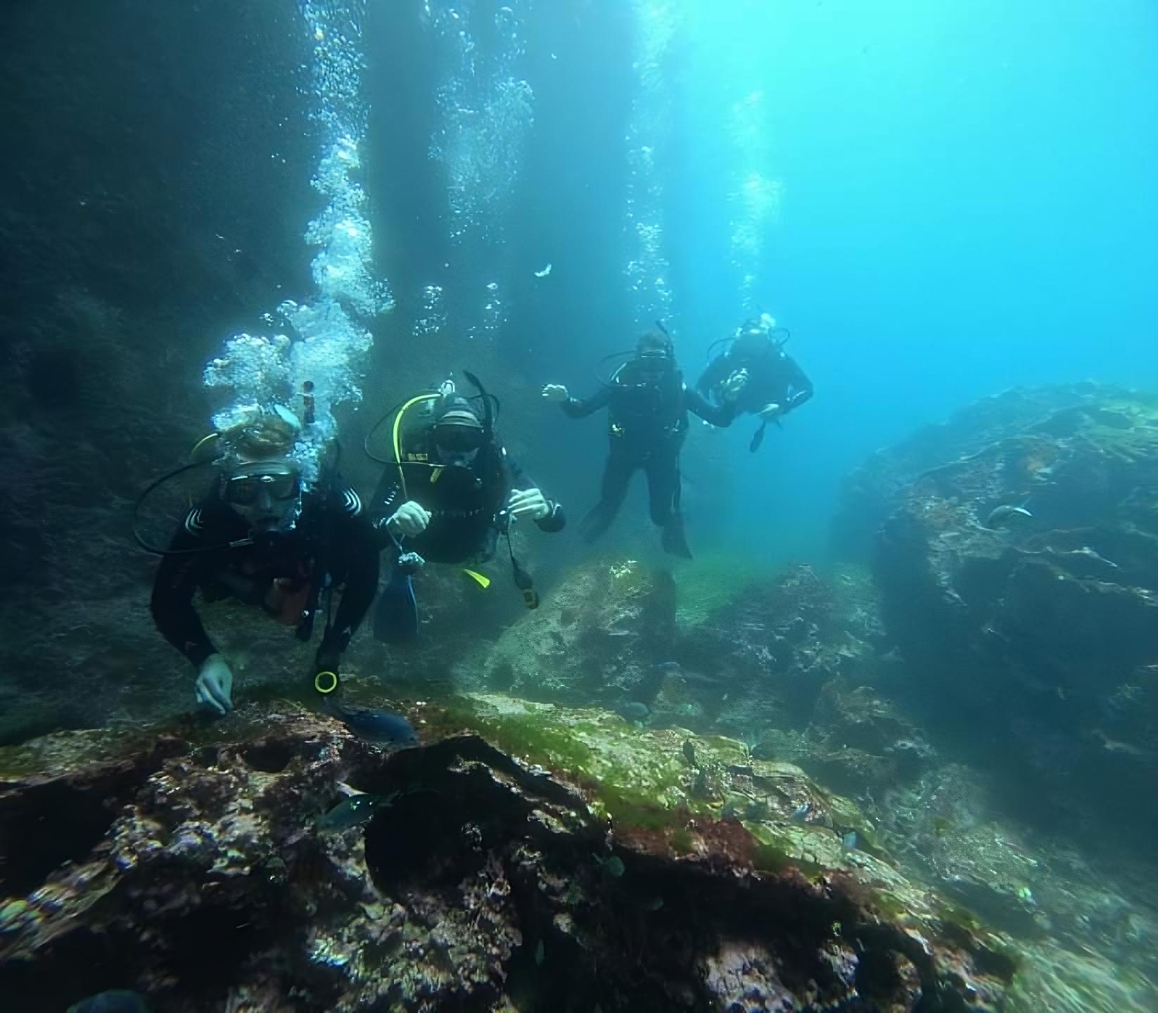
We then drove to one of the coolest dive sites at the Poor Knights: Middle Arch, named after the rock arch we would later dive through.

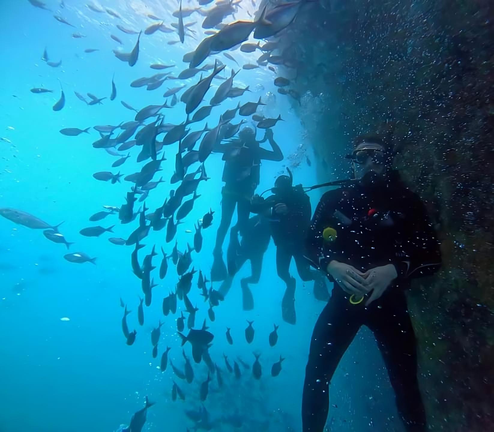
The last dive was by far the best and most spectacular of all. Fortunately, we were allowed to take the GoPro with us this time, as no more exercises were planned.
As we dived down, the bottom was about 80 m below us, as the almost vertical rock face of the cliffs continued just as steeply underwater. Of course, we didn’t dive quite that deep, but even at shallower depths there was more than enough to see.
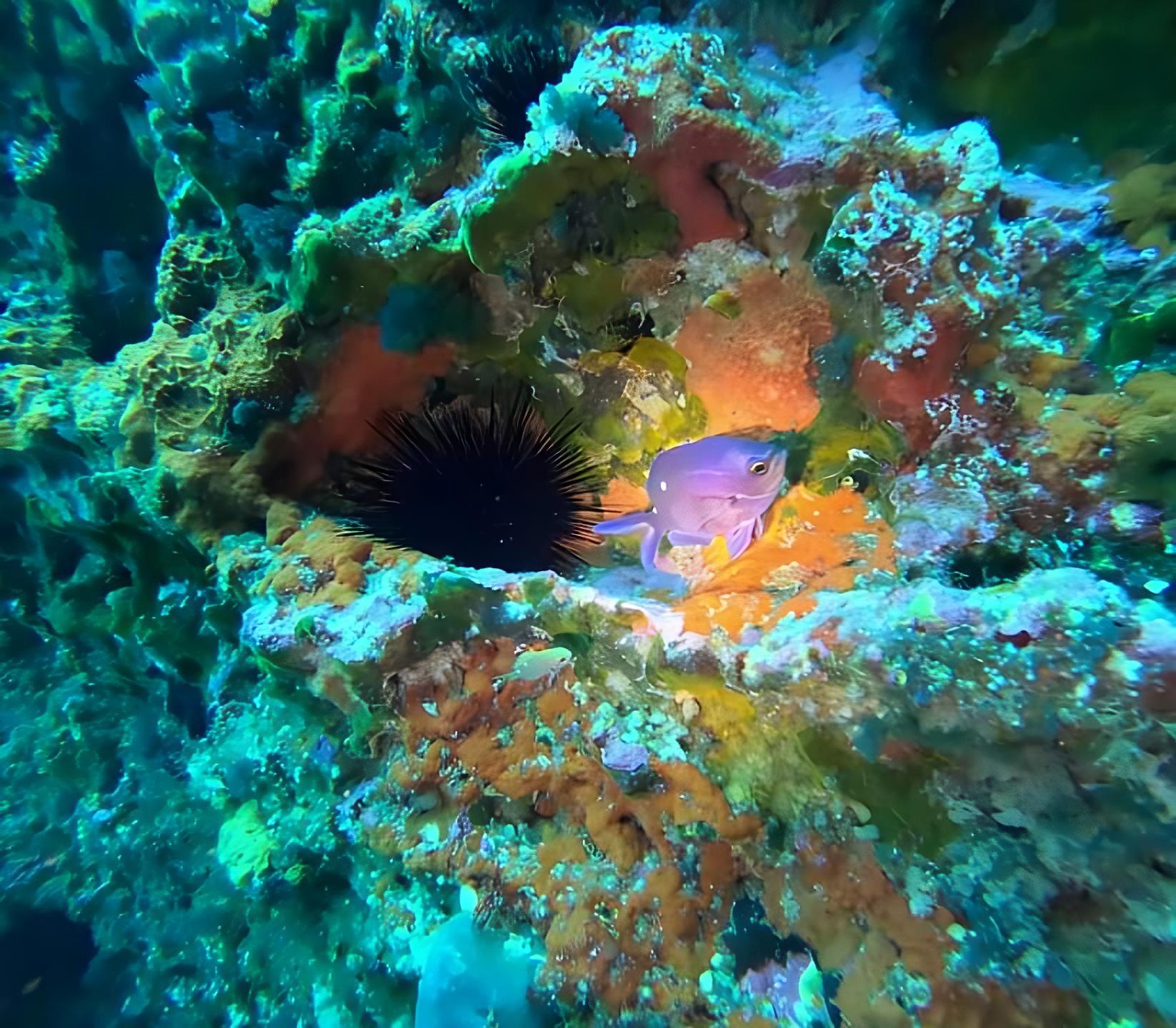
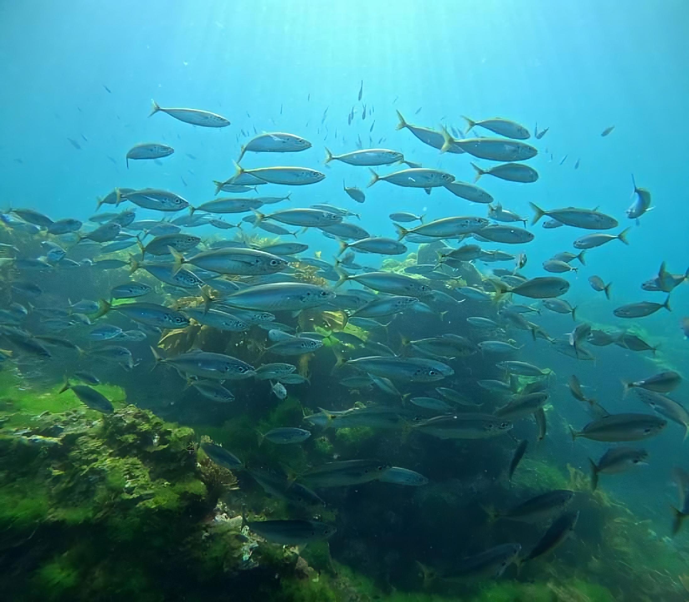
Between many small colorful fish and nudibranchs we dived down to 16 m and explored the area.
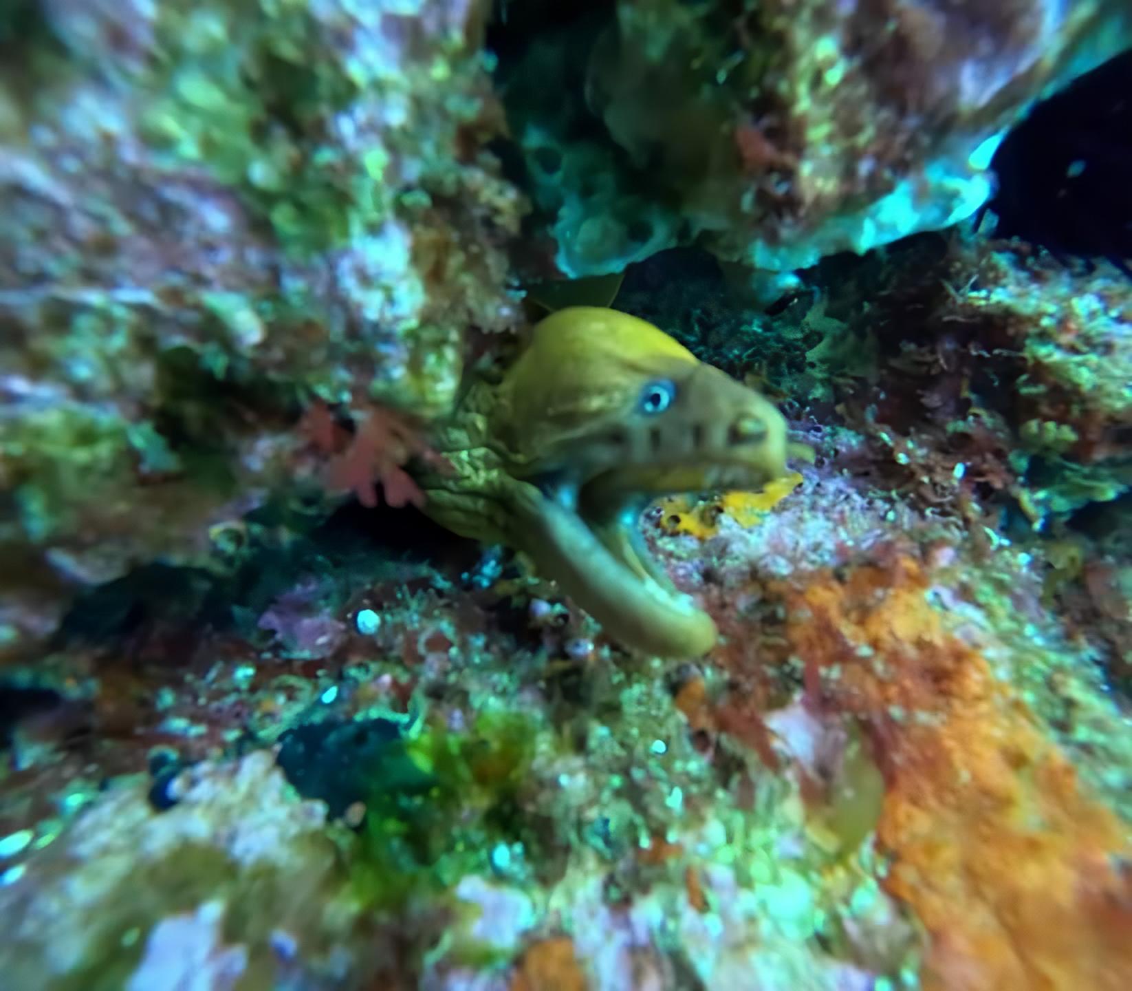
Small highlights were a territorial fish that seemed to be protecting its eggs and a moray eel peeking out of a crevice. Later we dived along the steep wall, where we were able to spot some more colorful nudibranchs. At another point, air bubbles slid up the rock face, but they couldn’t have come from any of us (or below us).
However, the biggest highlight surprised us at the very end, before we had to surface again: a huge school of fish that surrounded us all at once.
The feeling of being circled by so many fish was amazing, and even Charlie said afterwards that this hasn’t happened to him very often before. Unfortunately, this was also our time to swim back to the surface and say goodbye to the fish.
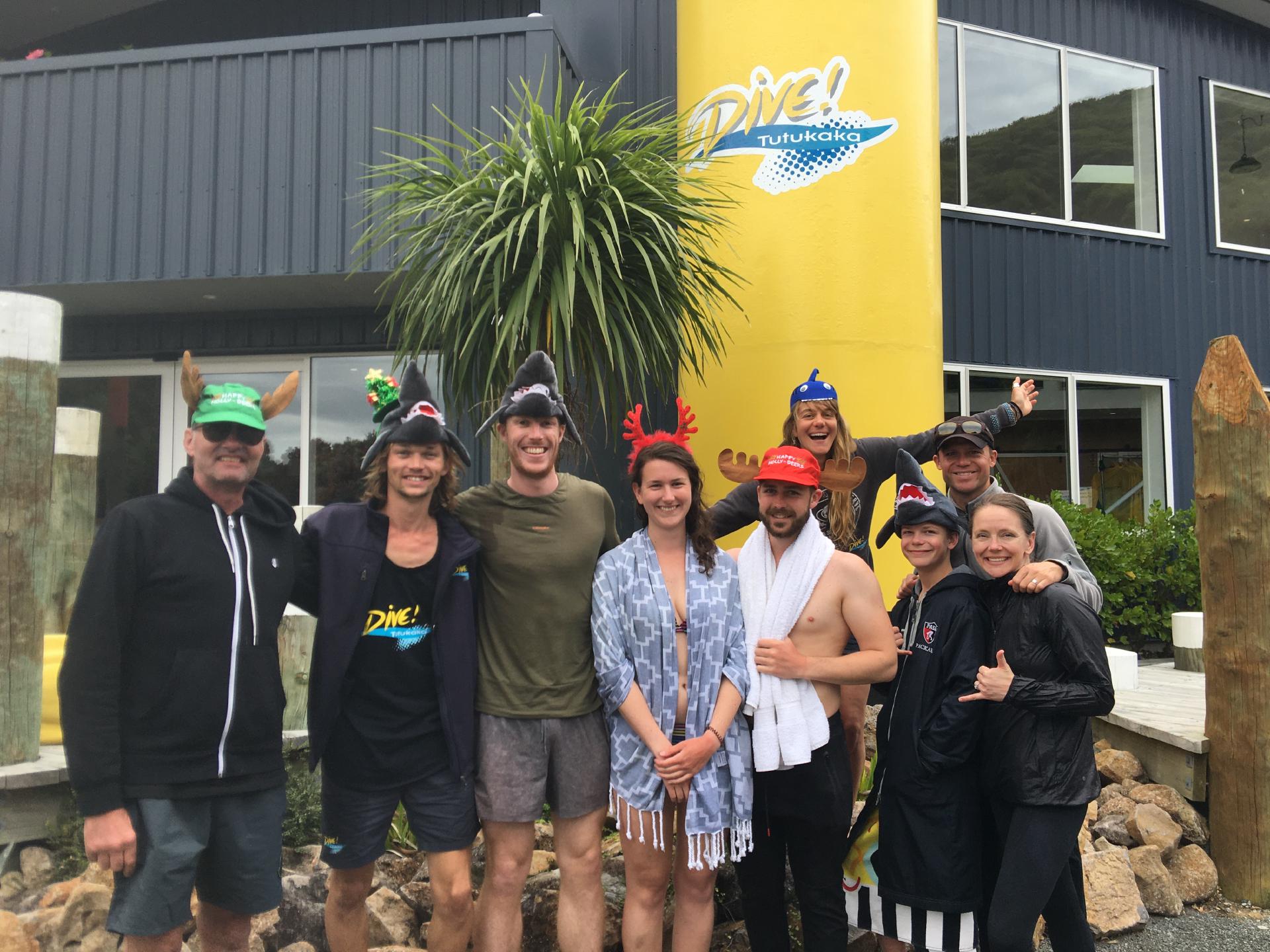
And with that we had completed the fourth and final dive and were officially “Open Water Divers”. 😎
Southern Arch
On the way back, we drove along the islands again and to the second largest rock arch in the southern hemisphere: the Southern Arch on the southernmost Archway island.
Meanwhile, the skipper told us more about other diving spots before heading straight for the arch to drive through it. The other boats followed us and we made our way back to Tutukaka together for the last time.

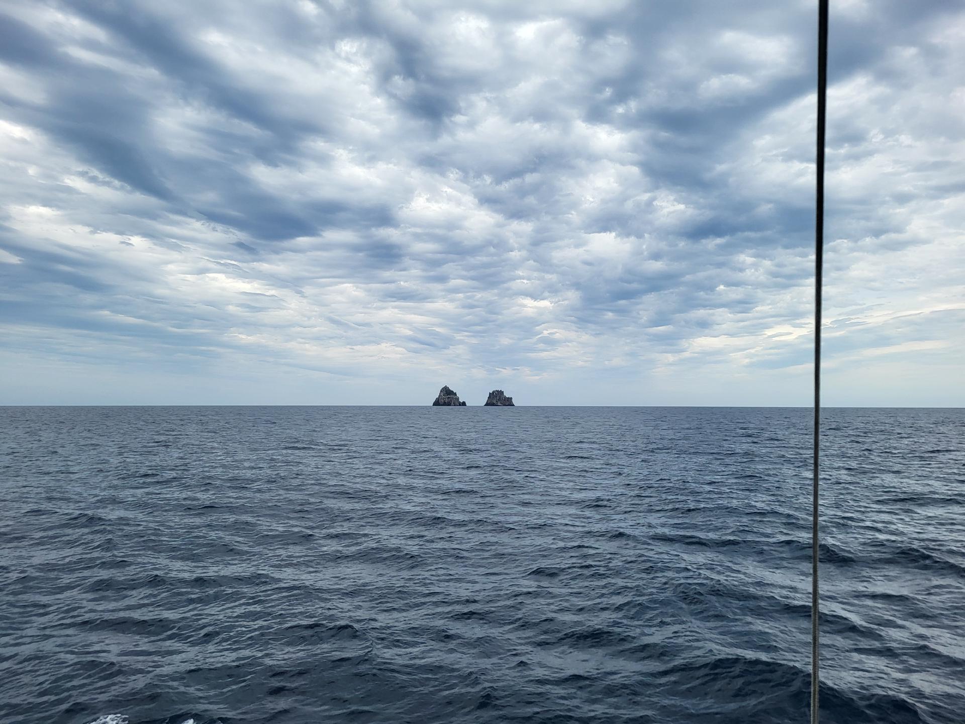
We saw the Pinnacles again from a distance and a little later stopped the boat for a short time because of a supposed whale sighting, which unfortunately could not be confirmed in the end.
Back in the harbour, we took photos for our diving certificates and Christmas photos before we said goodbye to each other and headed back towards Whangārei.