
Waiotapu Region (2/2)
December 29, 2023 • 14 minutes • 2969 words • Other languages: Deutsch
Table of Contents
Once we arrived at the parking lot, we had a snack accompanied by the chirping of a few Tui while we hid from the drizzle under the open trunk lid. Our second and final destination for the day was the Waimangu Volcanic Valley - the youngest geothermal ecosystem in the world. There you were able to walk as far as you wanted through the valley and hop on a shuttle bus at several stops to take you back to the start.
History of the Waimangu Volcanic Valley
June 10, 1886 – eruption of Mount Tarawera
The Tarawera volcano, the basin of Lake Rotomahana and the craters of the Waimangu Volcanic Valley, which lie above one of the largest fractures on earth (the Ring of Fire), were the scene of the largest eruption in recorded New Zealand history since European settlement.

The eruption began on Mount Tarawera at about 2 am after a series of gradually intensifying earthquakes. Over the next few hours, the eruption spread northeast and southwest from the site of the initial eruption, and from about 3.30 am a series of craters erupted simultaneously, extending nearly 16 km along a line from there to the northeastern end of the mountain. The hot phase of the eruption ended at about 5.30 am. Seven of the craters created in 1886 formed the Waimangu Volcanic Valley, and many others formed the basin where Lake Rotomahana is located today.
The immediate cause of the eruption was rising, red-hot, molten basalt magma, which reached the earth’s surface over almost the entire length of the Tarawera trench. Much of the energy released during the eruption was contained in very hot bodies of water that lay at shallow depths and formed the fluid reservoir that fed the famous hot springs of Rotomahana.
The massive destruction caused by the eruption not only covered the famous Pink and White Terraces , but killed more than a hundred people, leveled villages and changed the landscape of the Rotorua region forever.
The hot springs, geysers and other above-ground geothermal features of the hydrothermal system developed in and around the craters created during the 1886 eruption. But below the surface, this system extends from here toward the mountain and also south toward Rainbow Mountain , and in all likelihood has an area of several dozen square kilometers.
1886 - 1900
During this period, Lake Rotomahana formed and filled 15 of the eruption craters. The Echo Crater is an elongated crater that was originally hollowed out by the eruption and reshaped by subsequent hydrothermal explosions between 1900 and 1973.
The hot water and steam that make up the geothermal fluids in Waimangu and all other high temperature systems in the Taupō Volcanic Zone are predominantly rainwater that has seeped through the relatively porous rock of this region. At a depth of 5-10 km, it was heated by thermal conduction from even deeper magma. This heating causes the water to become more buoyant and rise to the surface in a convective plume, dissolving minerals from the rock it passes through on its way.
Immediately after the eruption, a heated groundwater lake formed in the Echo Crater. For about 18 months there was little sign of volcanic activity. Later, geothermal fluid from a previously hidden reservoir began to rise to the small lake, and surface activity of the Waimangu geothermal system began. In the late 1890s, erosion of the soft volcanic material covering the surrounding land gradually filled the bottom of the Echo Crater until the small lake had been almost completely displaced.
1900 - 1904 – Waimangu Geyser eruption
About every 36 hours, the largest known geyser in the world spewed boiling water, black sand, mud and rocks up to 400 meters high.
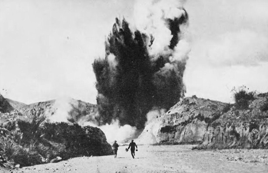
Waimangu (“black water”) was so named by its discoverers because of the appearance of its columns of sand and water when it erupted - today it refers to the whole valley.
Despite its enormous size, the Waimangu geyser was actually a real geyser, erupting in a fairly regular cycle of 5-6 hours. The reasons for the geyser’s demise are not fully understood. In mid-1904, the geyser was dormant for several weeks, and when activity resumed, the eruptions were shortened. In October 1904, its behavior became irregular and the eruptions weaker. The last time it was seen was on November 1, 1904.
At the same time, the water level of Lake Tarawera (located 5 km to the north) dropped by several meters when a sandbar downstream of the lake outlet collapsed. However, there was no obvious physical connection between the two events.
Following the extinction of the geyser, hydrothermal activity increased elsewhere in Echo Crater, culminating in the eruption of April 1, 1917.
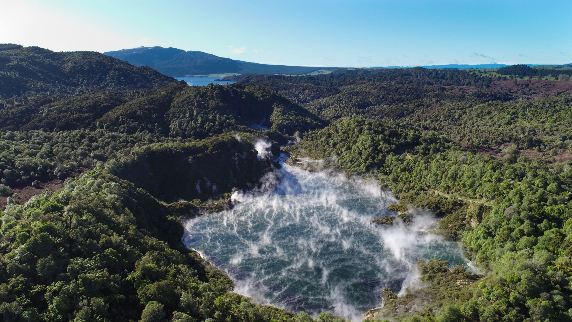
April 1, 1917 – Frying Pan Flat eruption
The eruption re-excavated the southwestern end of Echo Crater and almost completely blew away the Frying Pan Flat. Within two weeks, the Frying Pan Lake filled the crater and became the largest hot water spring in the world.

The steep and eroded landscape of Waimangu is accurately depicted in the painting. Of particular interest are the beginnings of vegetation on the deposits of the Tarawera eruption.
Today
Today Waimangu is still changing and developing. It is not only the youngest geothermal ecosystem in the world, but also the only one to have been created as a direct result of a volcanic eruption and the only example of a native forest in New Zealand that has re-established itself after being completely destroyed.
The Pink and White Terraces were long believed to have been lost in the volcanic explosion, but in 2011 researchers discovered surviving fragments of the terraces 60 m below the surface of the lake, with more recent research confirming the exact location of the terraces below the surface.
Hike through Waimangu Volcanic Valley
As always, we asked for a student discount at the entrance and were more than lucky - the lady signed us all off with a reduced ticket straight away. Armed with a relatively large map, we made our way downhill through the valley. As the starting point was the highest point of the trail, you had a beautiful view over everything from here. You could actually have seen as far as Mount Tarawera at the other end of the park if the clouds hadn’t been so dense.
Before the last eruption, this valley was a gentle bush landscape with no hydrothermal activity. The eruption destroyed all plant, animal and bird life in the entire valley as far as the eye can see. All the plants that grow here today only emerged afterwards.
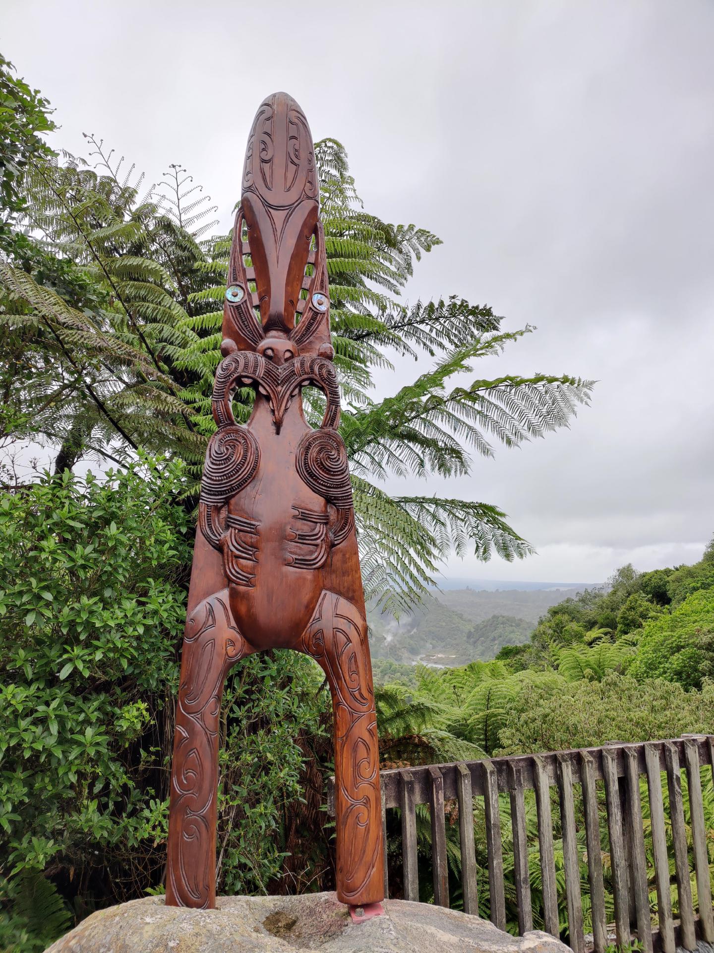
At the entrance to the park there was also Ruaumoko - a vessel of remembrance
Ruaumoko stands for earthquakes and all volcanic phenomena. He is the unborn child of Papatuanuku (earth mother) and Rangi (sky father). Papatuanuku was pregnant when she was turned face down towards Rarohenga (the underworld or spirit world). Therefore, Ruaumoko never appeared in the upper world or saw the light of day. Ruaumoko, along with his brother Whiro, wages war against the descendants of Tane (humanity) to avenge the separation of their parents. Whiro suggested that they should return to ao-turoa, the upper world, to fight.
But Ruaumoko said: ‘You belong to the upper world. Go there and fight. But I belong to the underworld and will fight my own war.
Whiro asked: ‘But what weapons will serve you?’
Ruaumoko replied: ‘I will procure one from Puna-te-waro, in which ahi-komau (underground fire) is kept.’
Māori believe earthquakes are caused by Ruaumoko turning around in his underground house. When summer approaches, he is said to turn the heat upwards, when winter approaches, the cold upwards. The Ngati awa people believe that Ruaumoko is also the source of the thunder he uses to separate summer and winter.
The first thing we passed was the southern crater, which didn’t look very spectacular at first.
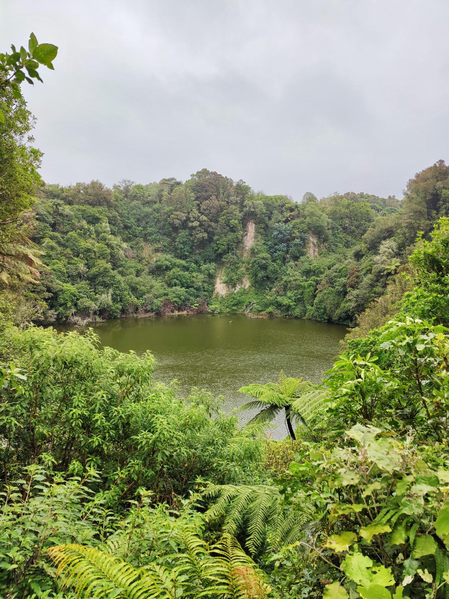
The Emerald Lake, a cold-water pond covering the floor of the southern crater, produces huge mats of algae and mosses when conditions are favorable. The native red, floating Azolia fern can sometimes be seen.

The lake is blue, brown or emerald at certain times. The reason for this color change is due to the different plants. The lake is largely fed by rainwater. Its water level corresponds to the groundwater level of the surrounding area. Its average depth is 2 m.
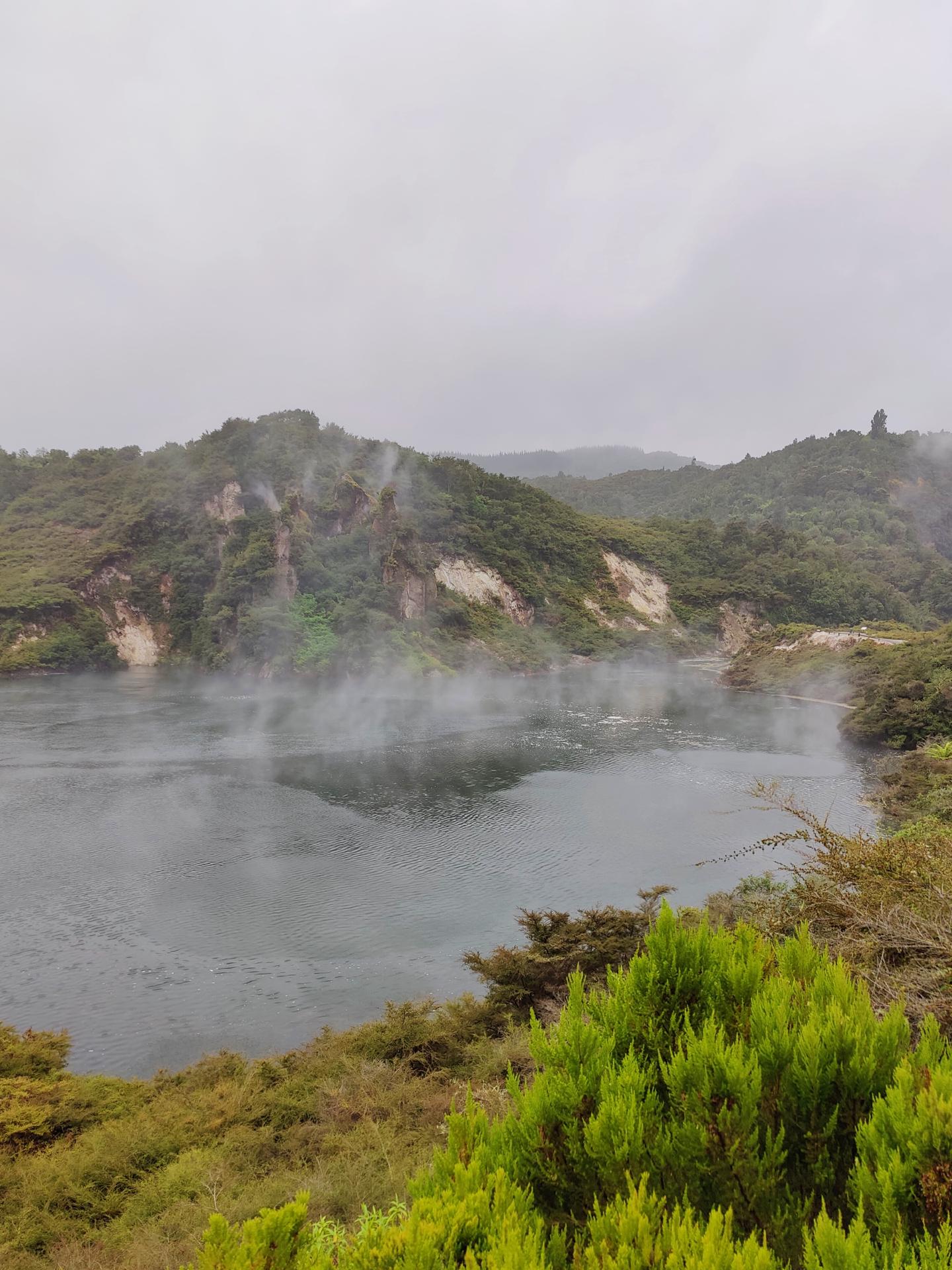
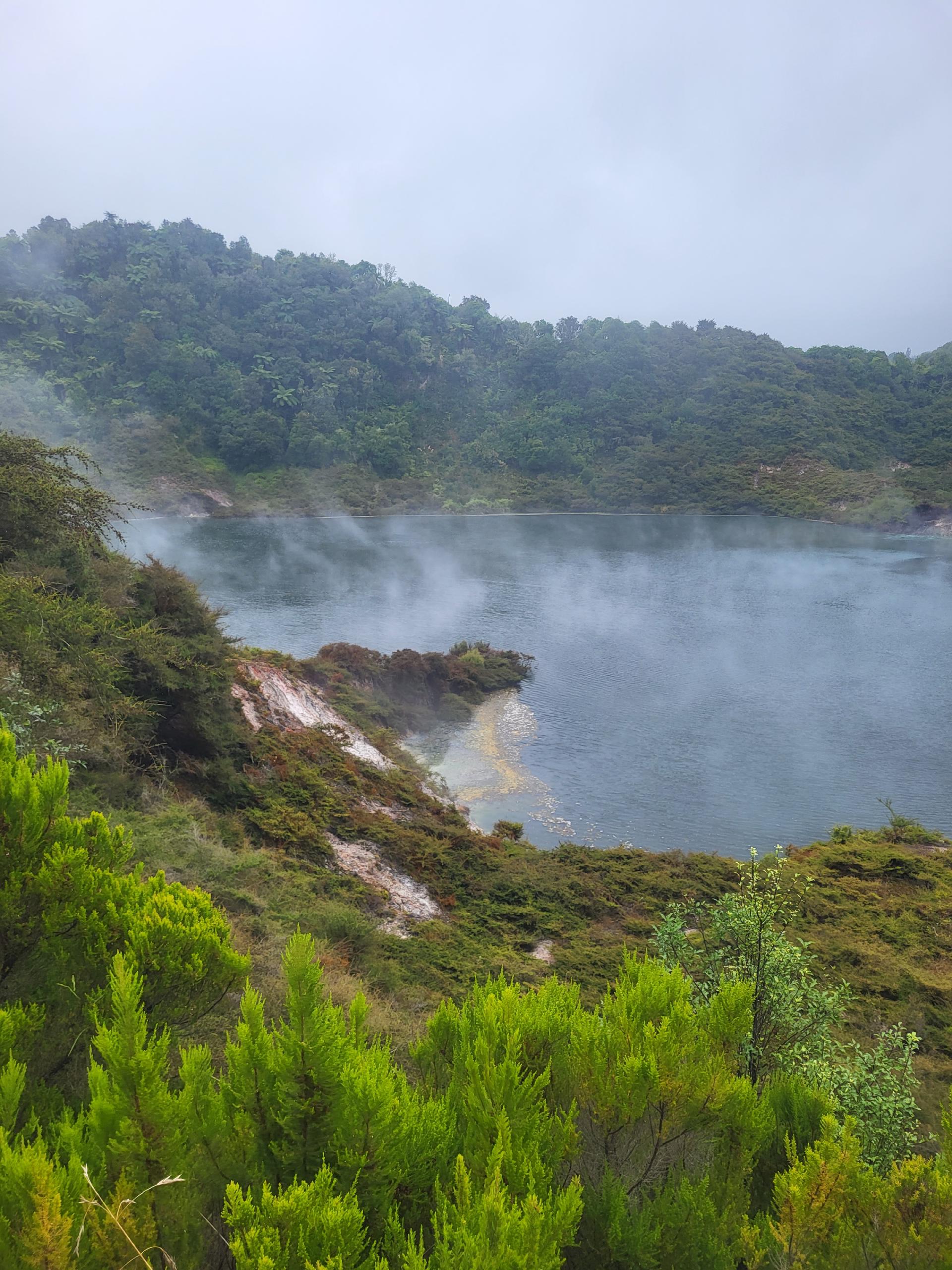
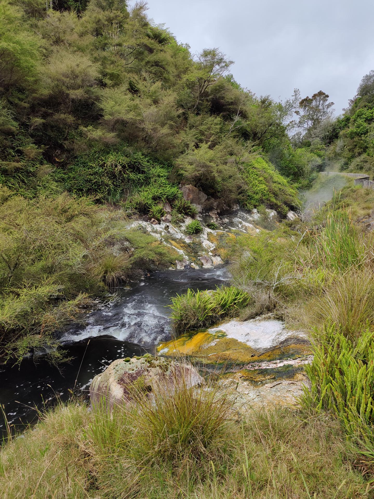
Slightly off the main path, there was a small hill from which one had a beautiful view of the Echo Crater and Frying Pan Lake. The red deposits at the edge of the lake were formed during the eruption of the Echo Crater. These deposits are typical of a hydrothermal steam eruption, which can include anything from clay to boulders. A reddish color can be seen where these deposits are still being heated.
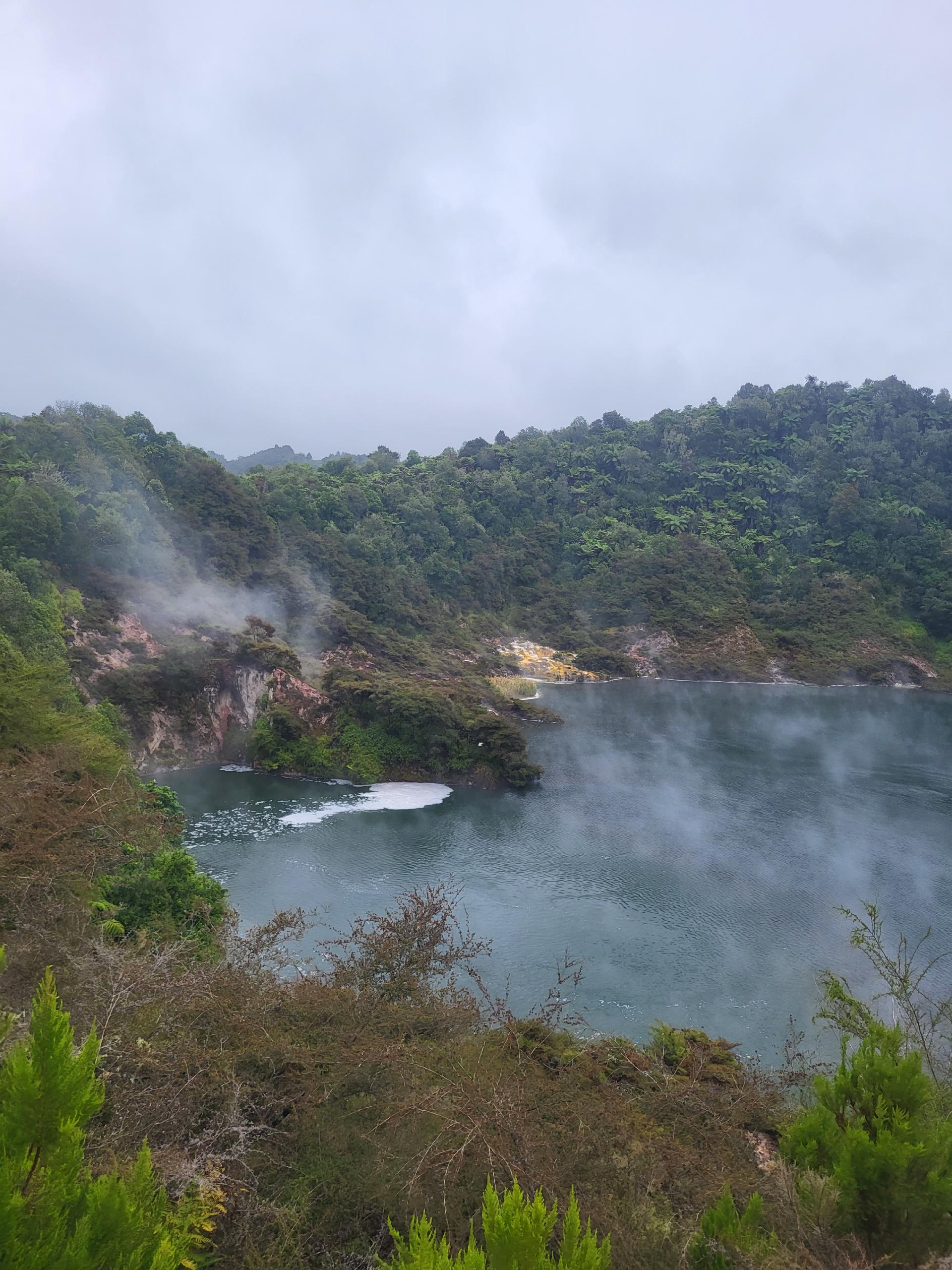
The lake is the largest hot water spring in the world with an area of over 38,000 m2 and has an average depth of 6 m and a water volume of around 200,000 m3. The average temperature is 55°C.
The water in the lake is acidic with a pH value of about 3.5. The carbon dioxide and hydrogen sulphide gas give the impression that the water is boiling. In fact, boiling water is coming out of the openings in the bottom, but the bottom of the lake is much colder due to the evaporation and mixing of the water, as well as the heat radiation.
The bubbling area, 10 m from the lakeshore, was the scene of the Trinity Terrace eruption in February 1973. During the 15-minute eruption, which occurred at night, mud was thrown more than 100 m in radius. This was one of the larger eruptions of the Echo Crater since 1917 and remains the last eruption to date. The accumulation of Kanuka trees spread again after the 1973 eruption.
Located at the end of Frying Pan Lake was Cathedral Rock. Originally called Gibraltar Rock because of its resemblance to the famous rock at the western mouth of the Mediterranean. This steaming monolith had completely changed its shape during the eruption of Frying Pane Lake and its remaining spires gave it its new name. This massive lava formation is at least 60,000 years old and thus much older than Mount Tarawera.

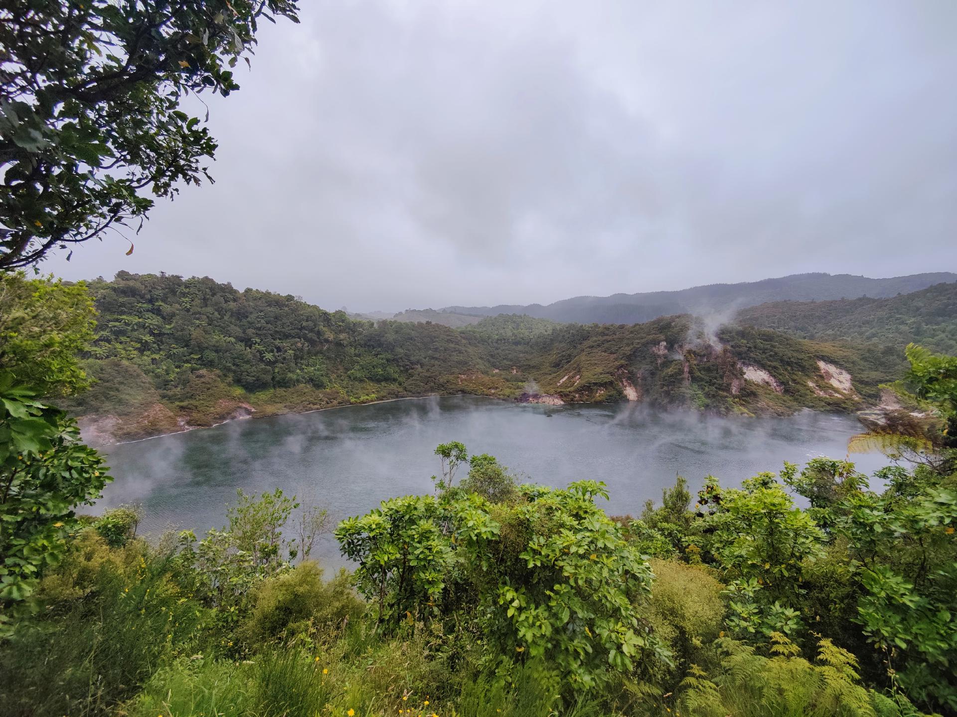
Directly opposite was the former large basin of the Waimangu geyser, surrounded by hills on three sides. In August 1903, the tourist guide Alt Warbrick launched a rowing boat on a bet. With a partner, he measured a depth of only 14.6 meters. This unexpected result was attributed to the fact that the massive material thrown up by the eruptions fell back into the fissure each time. The lake covered an area of 80 m x 130 m.
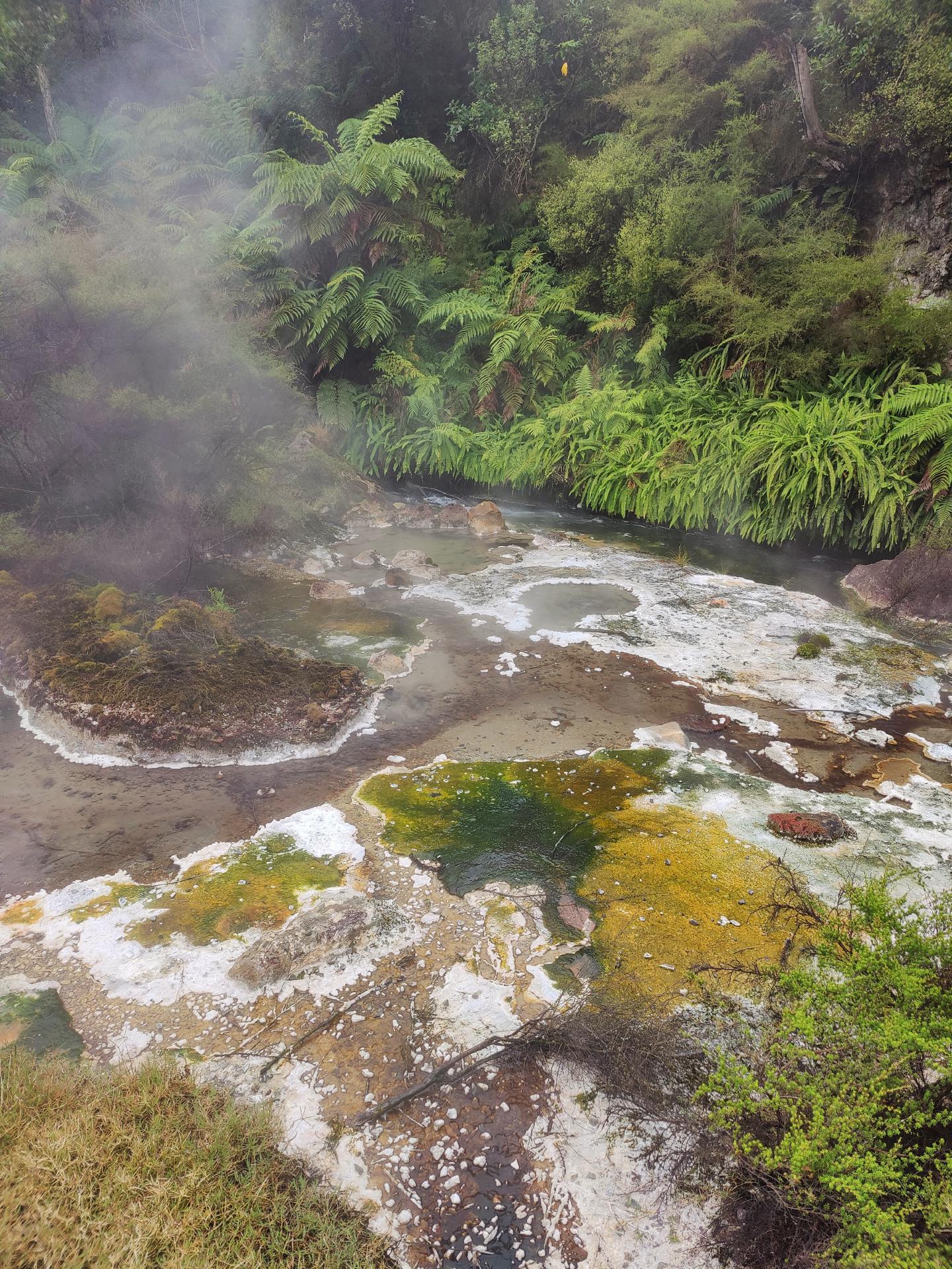
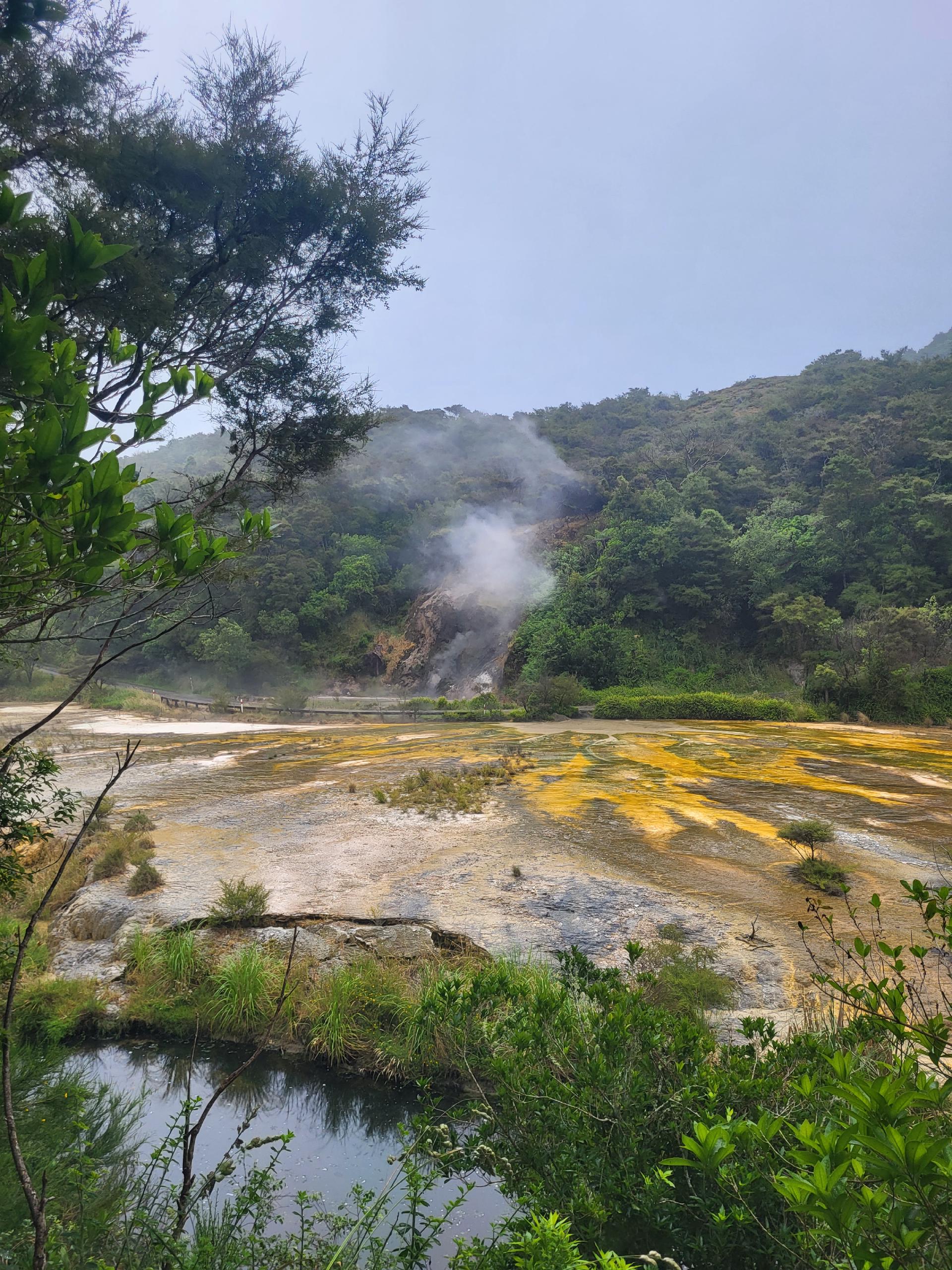
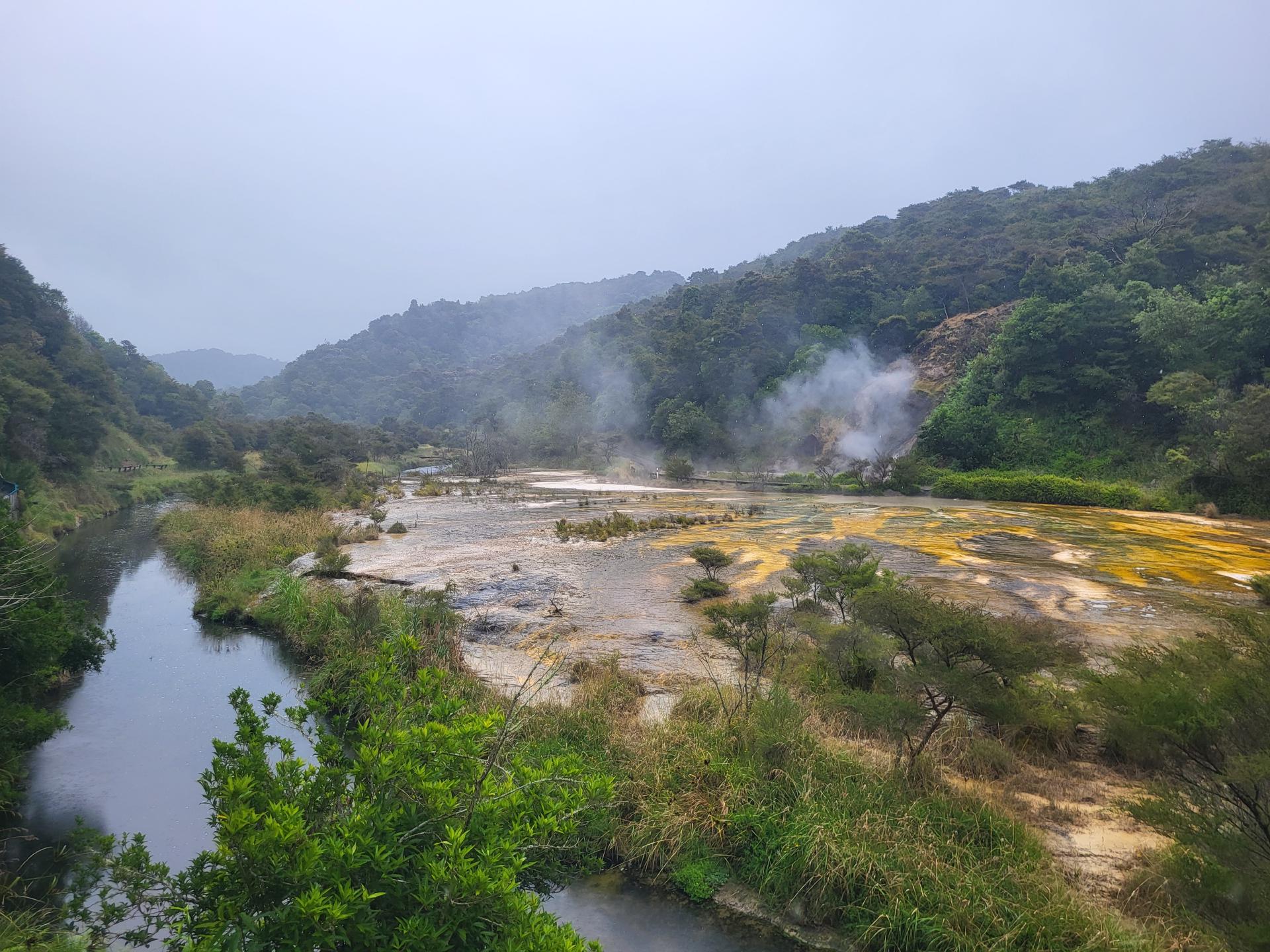
The Frying Pan Lake flows over this outflow at a temperature of about 50°C and 110 l/s. The deposits at the edge of the river contain traces of antimony, molybdenum, arsenic and tungsten. These minerals, together with the blue-green algae, produce the spectacular colors of orange, brown, green and yellow at the edge and at the hot springs.
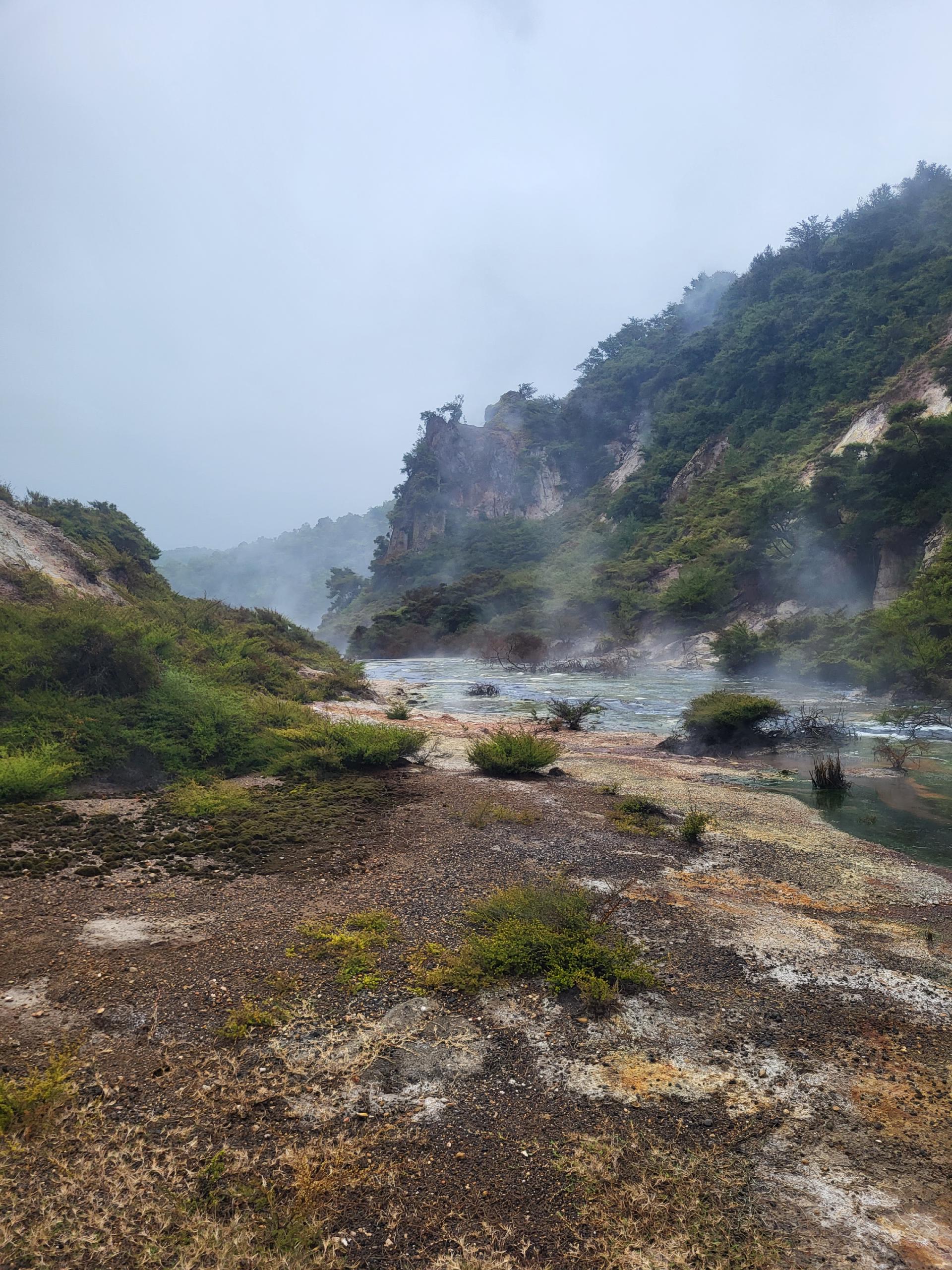
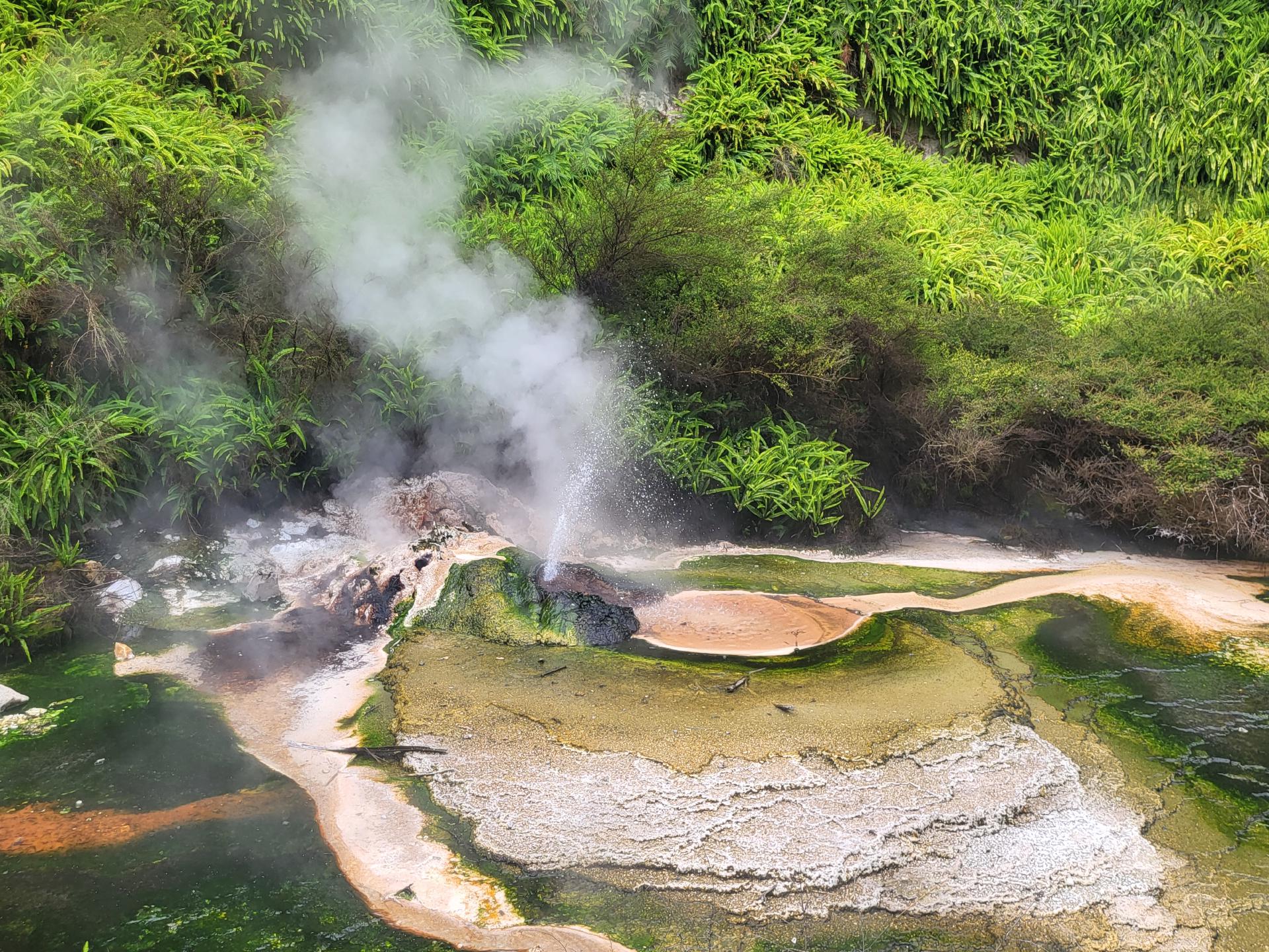
The Hot Springs of Mother Earth (Nga Puia o te Papa) - a cluster of vigorously boiling hot water springs - produced an intricate and impressively colored, reduced silicate assemblage.
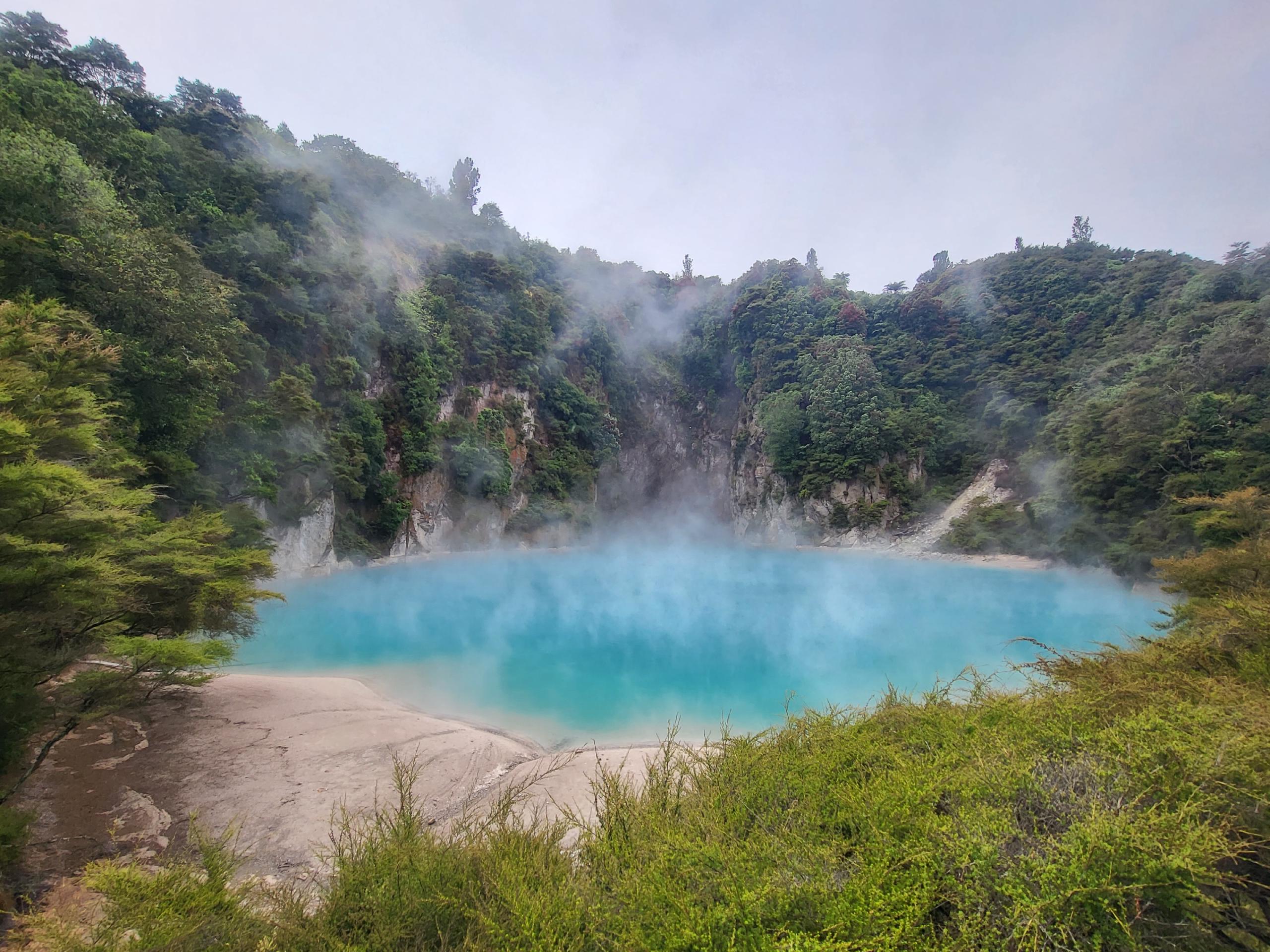
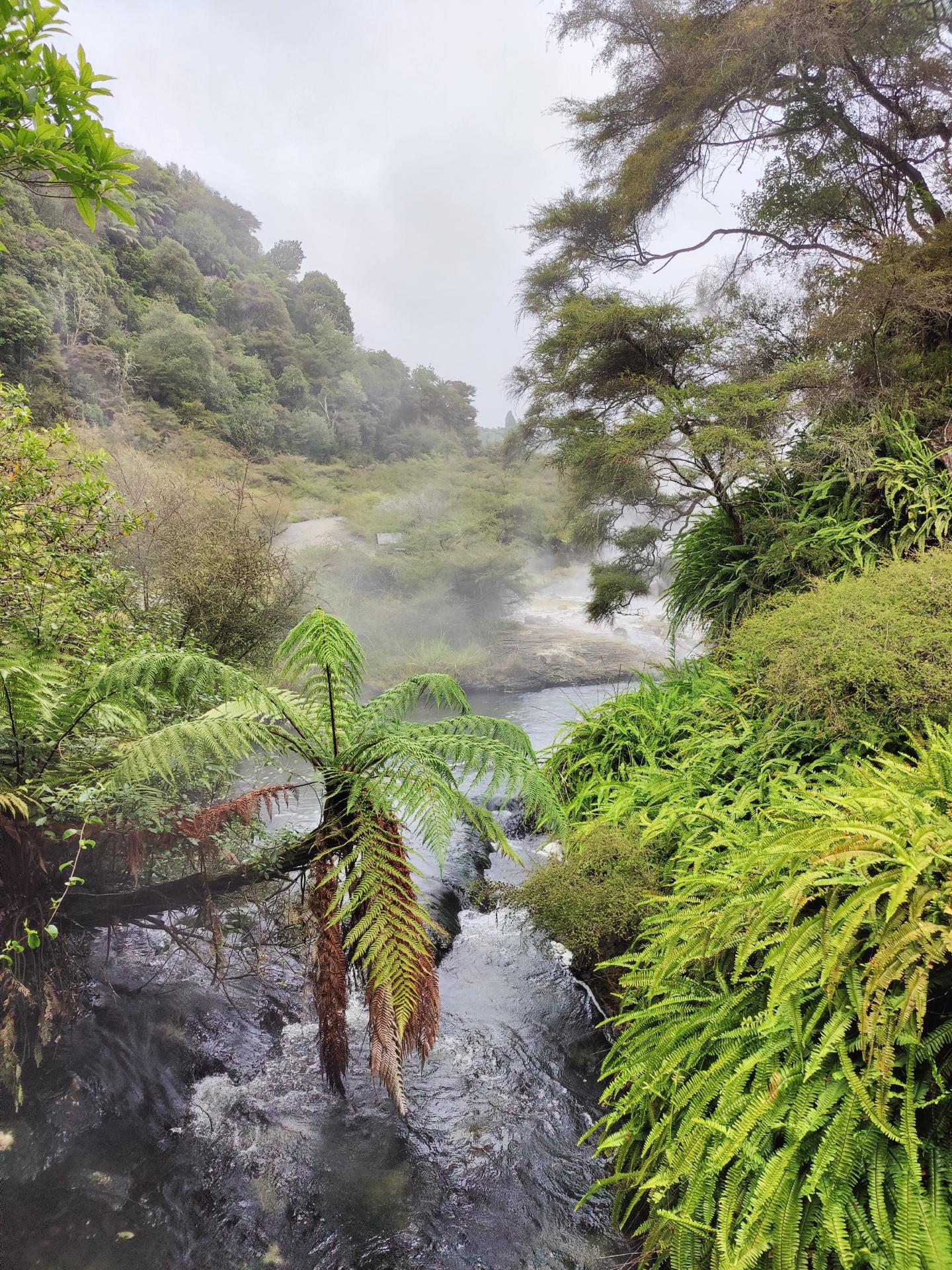
The path followed the steaming river, past the lush green ferns and palms, before branching off towards Inferno Crater Lake, to which a few steps led up.
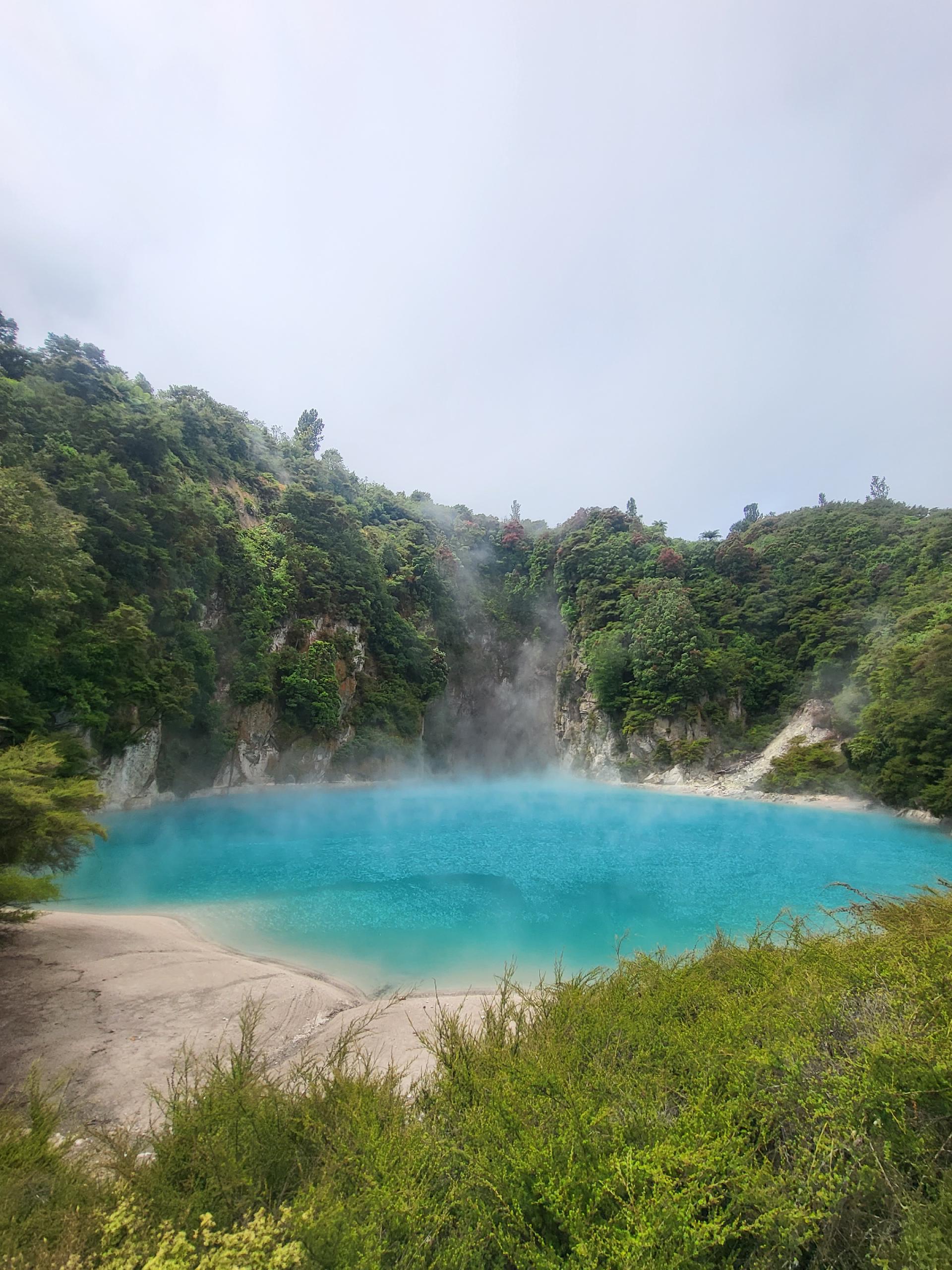
This steaming and unusually cloudy blue highlight of Waimangu lies in a crater that was formed in 1889 in the flank of Mount Haszard. The Inferno Crater Lake is the largest geyser-like structure in the world, although the geyser itself is not visible as it is located at the bottom of the lake.
The name of this crater is a variation of the quaint informal name Gateway to the Inferno, used by the surveyors who first mapped the area after the 1886 eruption to describe this “gateway to the underworld”.
The geothermal fluid that makes up Inferno Crater Lake exhibits a unique cyclical rise and fall in water level that accounts for a depth difference of up to 12 meters. Every 38 days, both Frying Pan Lake and Inferno Crater Lake show changes in their temperatures, overflow and water levels that appear to be interrelated. The upper limit of the silicate deposits marks the overflow limit.

Usually the lake overflows for 2-3 days, then recedes about 8 m during 15 days, partially fills up again in 3-4 weeks, fluctuates for a while and then overflows again. When the lake recedes after overflowing, about 30,000,000 liters of water flow back under Mount Haszard. The bottom is shaped like a trumpet.
When the temperature and water level of Inferno Crater Lake rise, the opposite seems to happen at Frying Pan Lake: the outflowing water decreases.
When the lake is full, it has a depth of 30 m and the overflowing water has a temperature of up to 80° C. The water is extremely acidic with a pH value of up to 2.1.
The color of the lake changes depending on the amount of turbulence it is exposed to. At low water levels it is often grey, but under ideal conditions (e.g. a few days after the end of the overflow) it can take on an intensely bright sky-blue color. This appearance is caused by finely dispersed silica that is kept suspended in the water. Today we were also lucky enough to see it in its bright blue color.
Back on the main trail, we next passed the Bird’s Nest Terrace. There, multi-colored algae floated on the fragile, small silicate terraces formed by these boiling springs. The different colors are caused by the different temperatures of the emerging water. The blue-green algae can only survive up to 75°C.
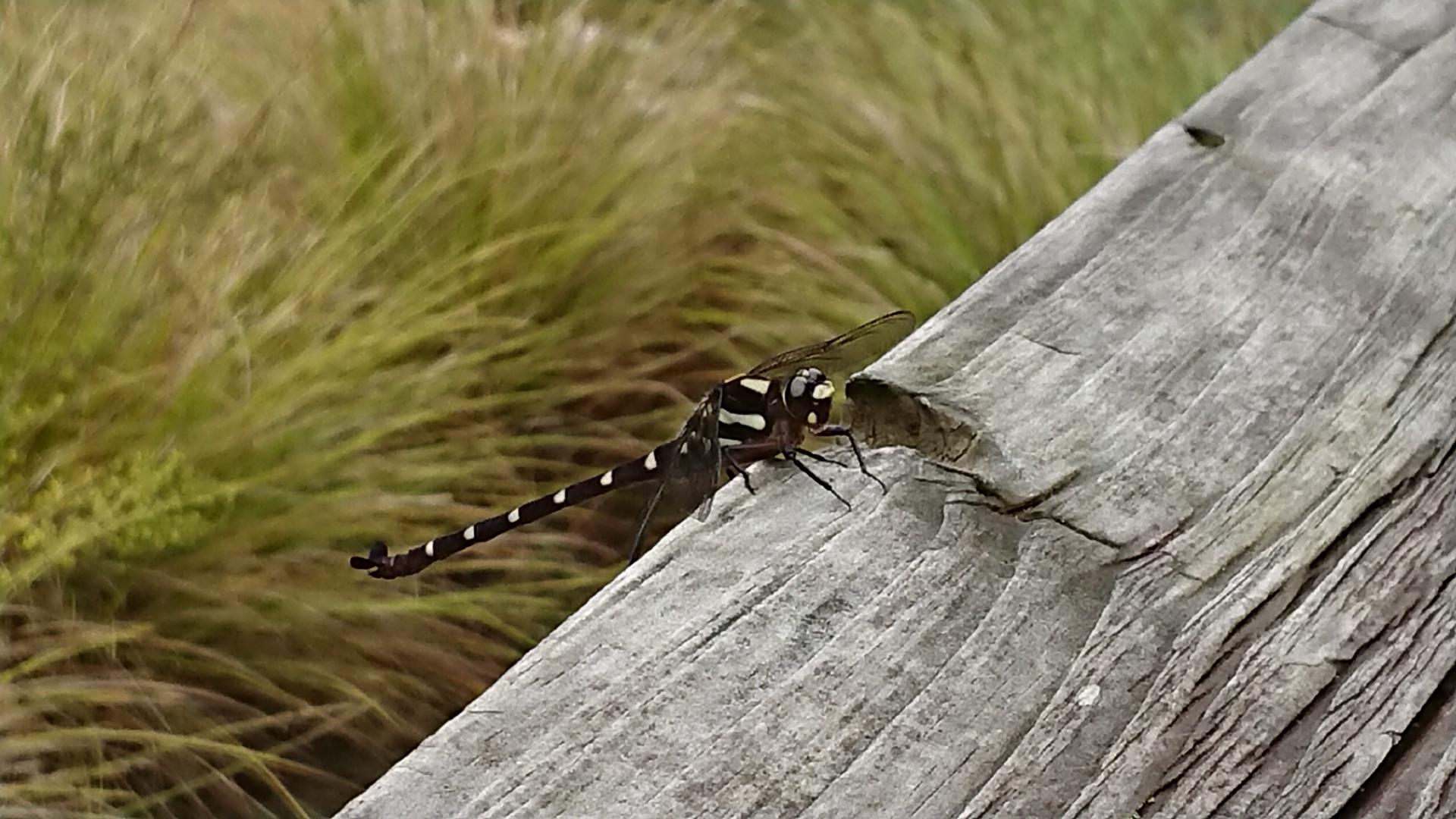
While we were still busy taking photos, our parents spotted a surprisingly large dragonfly a little further on, which had frightened another visitor to the park.
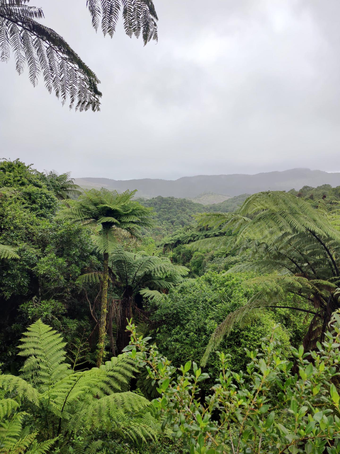
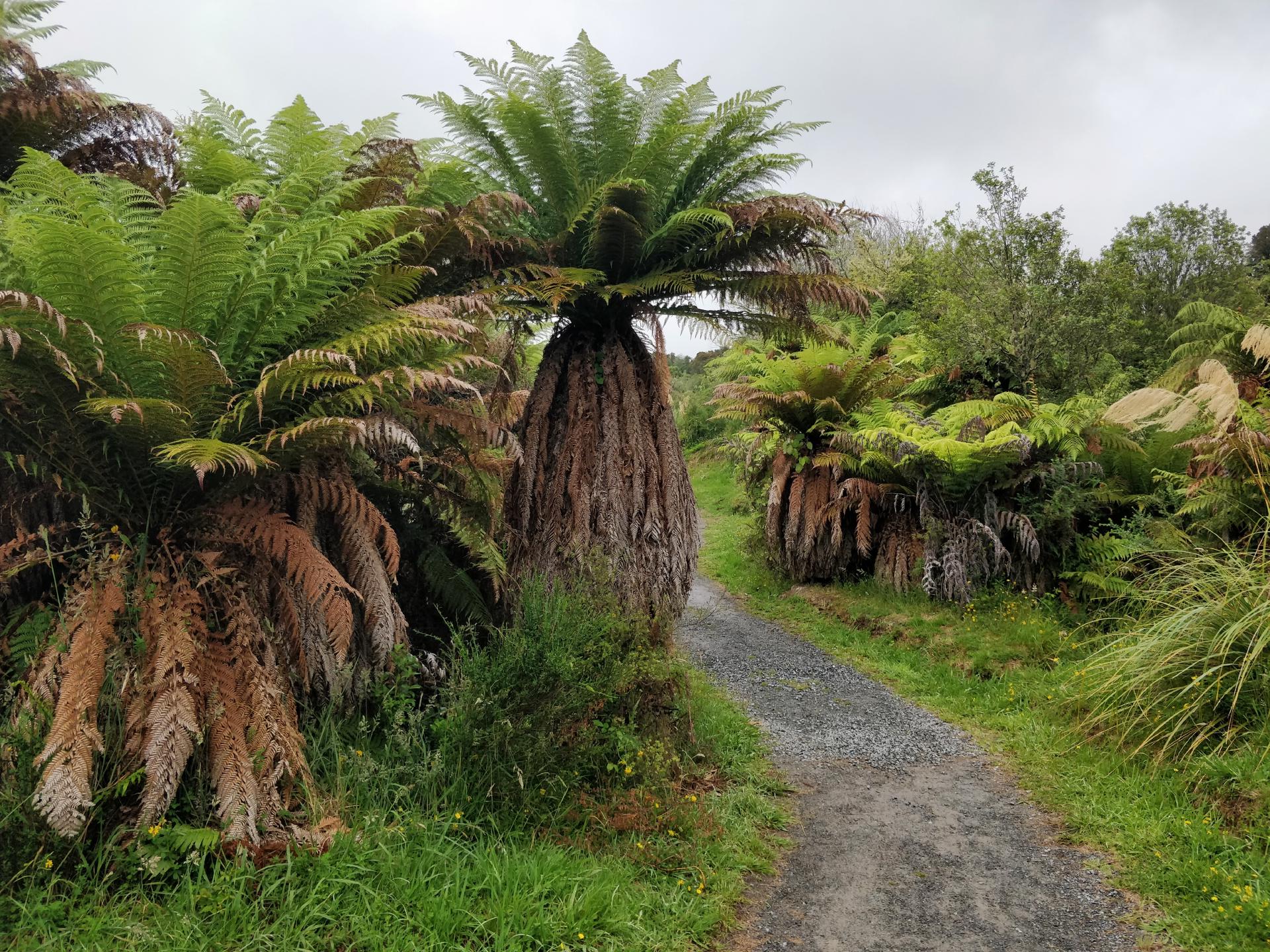
A mixture of mosses, ferns and lichens thrive in the warm, humid and shady climate. After the path had meandered a little through the bright green nature, we came to the first bus stop. However, as the weather was still holding up, we decided to walk to the next one and then return from there.
The clearly visible black layer on the slope consisted of debris that was thrown into the air during the eruption of Mount Tarawera. The white pumice layer under the black mass of rubble is almost 2000 years old and originates from eruptions of Lake Taupō in the past millennia.

At the next small viewpoint we could even make out the outline of Mount Tarawera in the background, directly behind Lake Rotomahana.
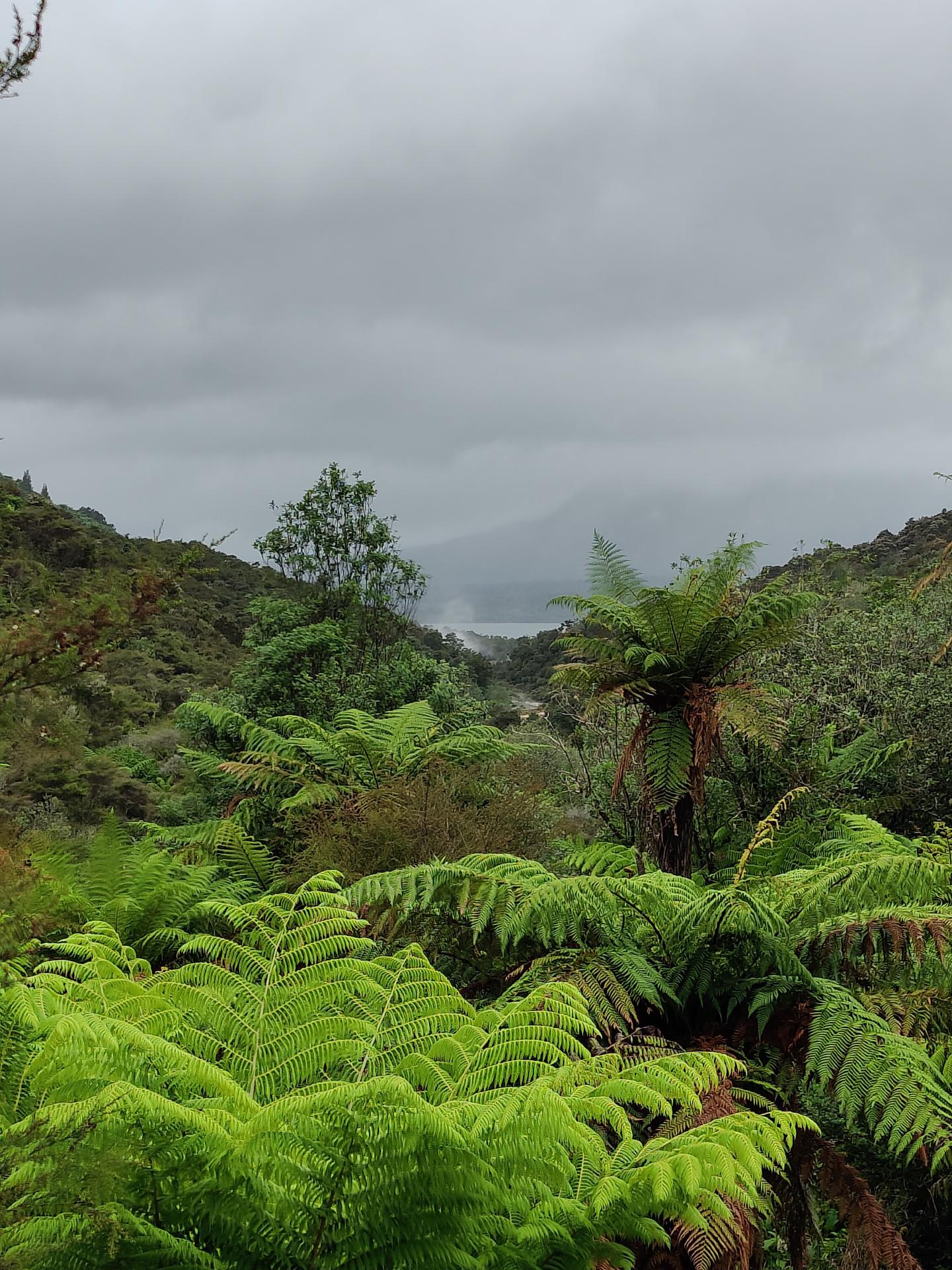
The path led us through the native forest for a while before we came across more hot water springs.
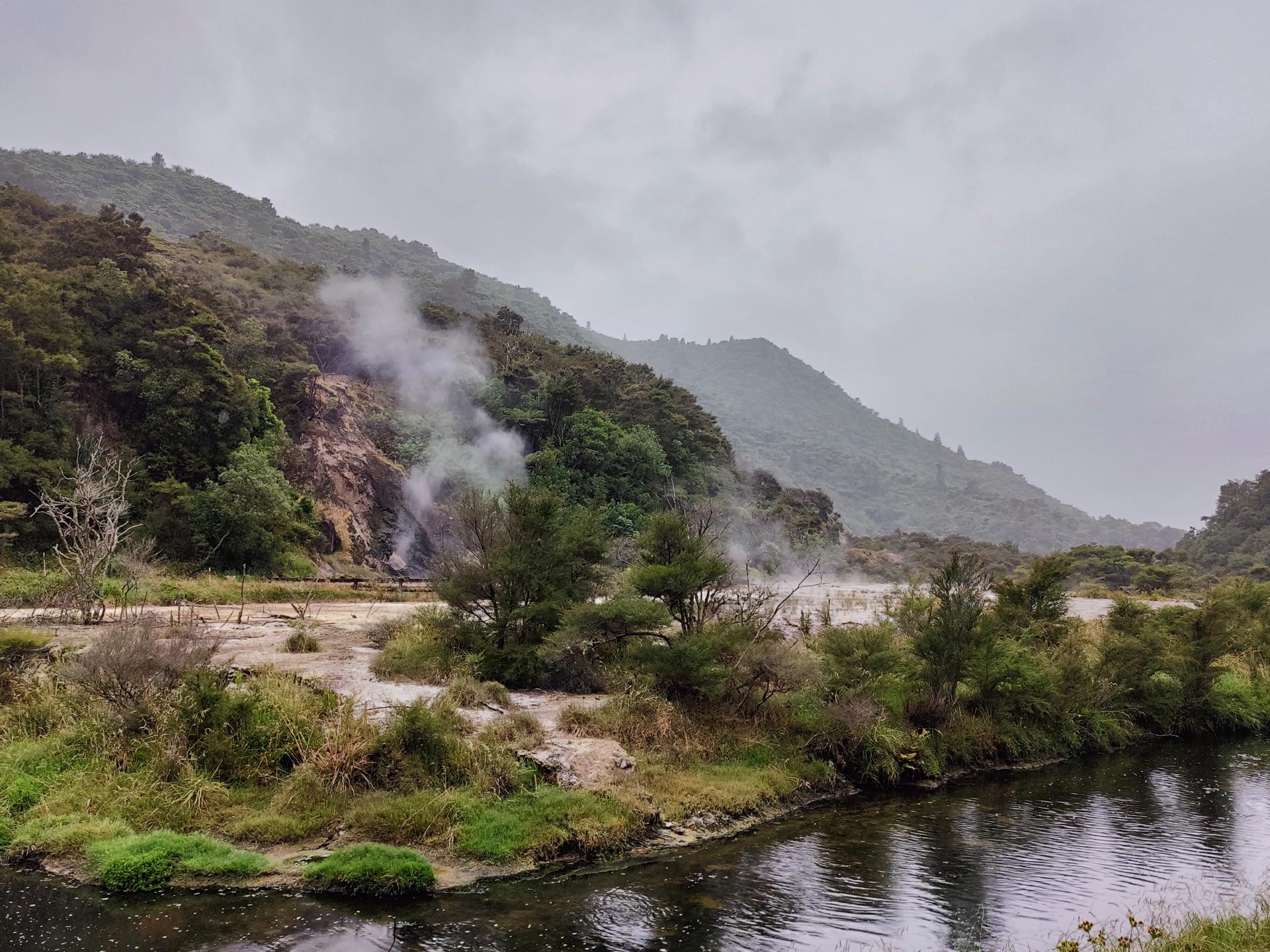
Along the river was an unusual collection of steam vents, a large hot spring and plants.
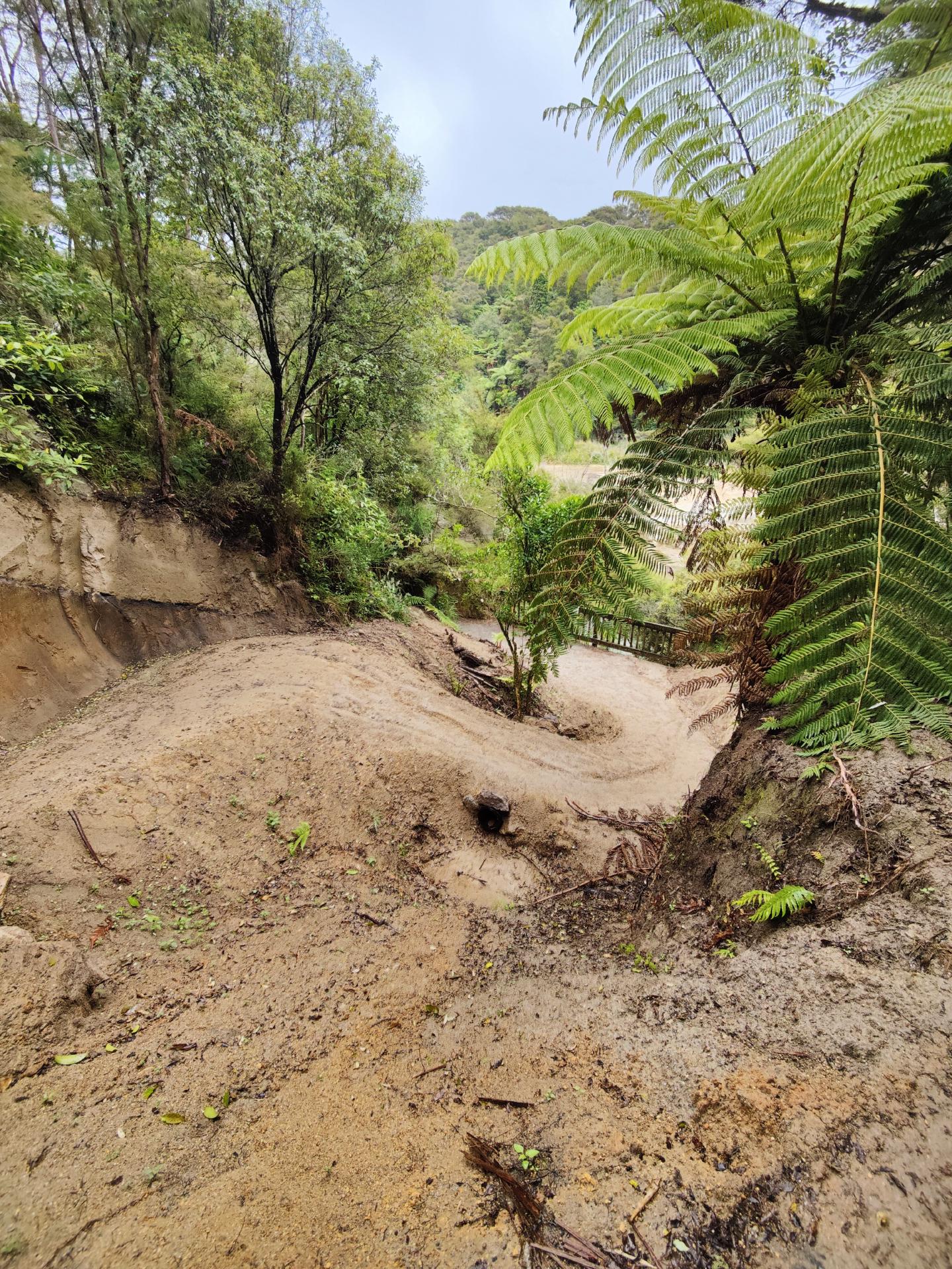
The rest of the way was a little different than originally planned, as there had apparently also been a landslide here not too long ago. The replacement path was temporarily formed on its remains and looked quite slippery. Fortunately, we all made it to the top safe and sound. It was just fortunate that we didn’t have to walk down again.
The next sintered surface - Marble Terrace - was formed from similar material to the Pink and White Terraces. The marble was formed over time from silicate in successive layers. The silicate-rich water flows from a large hot spring in the Iodine Pool at an average temperature of 97°C in shallow waves over the Marble Terrace. These grow over a river terrace that was created when Lake Rotomahana had a higher water level in the 1970s and the river occasionally flooded the area. The name of the Iodine Pool comes from the brownish color of the stones and slopes.
The next bus stop was already on the other side of the terrace. As we still had some time before the next scheduled bus was due to arrive, we took a short walk towards the next terrace.
Shortly afterwards, however, we heard a bus approaching and quickly turned around. As there were more visitors on the way, they had sent an additional bus to take us down to the lake and the last stop before going back up. We briefly considered getting off at the bottom to have a look at the lake. However, there were so many people waiting for the bus that we definitely wouldn’t have got a seat again. So we decided to go back straight away. You could tell that the bus driver was often on the road here, as he navigated even the tightest, overgrown and confusing bends very quickly.
Once back at the car, we drove back to Rotorua, to our parents’ accommodation. On the way home, we once again passed a car that had been involved in an accident on the side of the road, which - as is so often the case - had simply been left here.
By now it had started to rain more heavily, which is why we quickly fled inside. In the morning, there had apparently been alpacas in the garden next to the accommodation, but they seemed to have been in the stable already when the rain had subsided and we went back outside. Our parents also had a terrace with a usually very good view over the whole of Rotorua and a hot tub. Unfortunately, they couldn’t really enjoy most of it in this weather, but at least they would get to see the view the next and last morning in this accommodation…